Glendahurk Horseshoe trek, (Part 3) Glenamong and the Corrannabinnas ⛰️🧗♂️
“All good things are wild and free.”
Anon
Today’s adventure brought me back to the Bangor Trail sooner than expected. After my previous excursion up Nephin Beg, I was eager to tackle the Glendahurk Loop walk part 3. The plan for today was to climb to the summits of Glennamong, Corrannabinna, and Corrannabinna South West Top, covering a distance of about 15-20 kilometers. Anticipating a long day of serious hiking, I was particularly thrilled to navigate the renowned arête between the two Corrannabinnas for the first time.

Glennamong pictured from Nephin Beg.
Planning for such an extensive solo trek required careful preparations, including arranging transport drop-off and pickup locations in advance. As I made my way to the Letterkeen Trailhead, the promising mountain weather forecast added to the excitement. While the terrain ahead promised to be challenging, the adventure and the stunning landscapes ahead made it all worthwhile.

The trek begins at the Letterkeen Trailhead and proceeds into the mountains by following the Bangor Way.
Letterkeen to Glennamong
Setting off near the Bothy in Letterkeen, my journey led me up the Bangor Trail, a beautiful route that winds through picturesque surroundings, setting the stage for the adventure that awaited. After about 3 kilometers, I veered left, beginning the ascent up the north-facing Glenamong spur.

On the Glennamong spur looking out towards Birreencorragh and Buckoogh Mountains.

Lough Aroher on the Letterkeen loop walks
As I traversed the spot heights along the spur, the enthralling views came into focus. I could see the renowned Bangor Trail winding its way from the north, the surrounding mountains of the Nephin Beg range, Clare Island out in Clew Bay and the mountains of Achill Island to the west.

As I got closer to the summit, this breathtaking picture gradually opened up. Below is Corryloughaphuill Lough nestling into the Corrannabinnas.
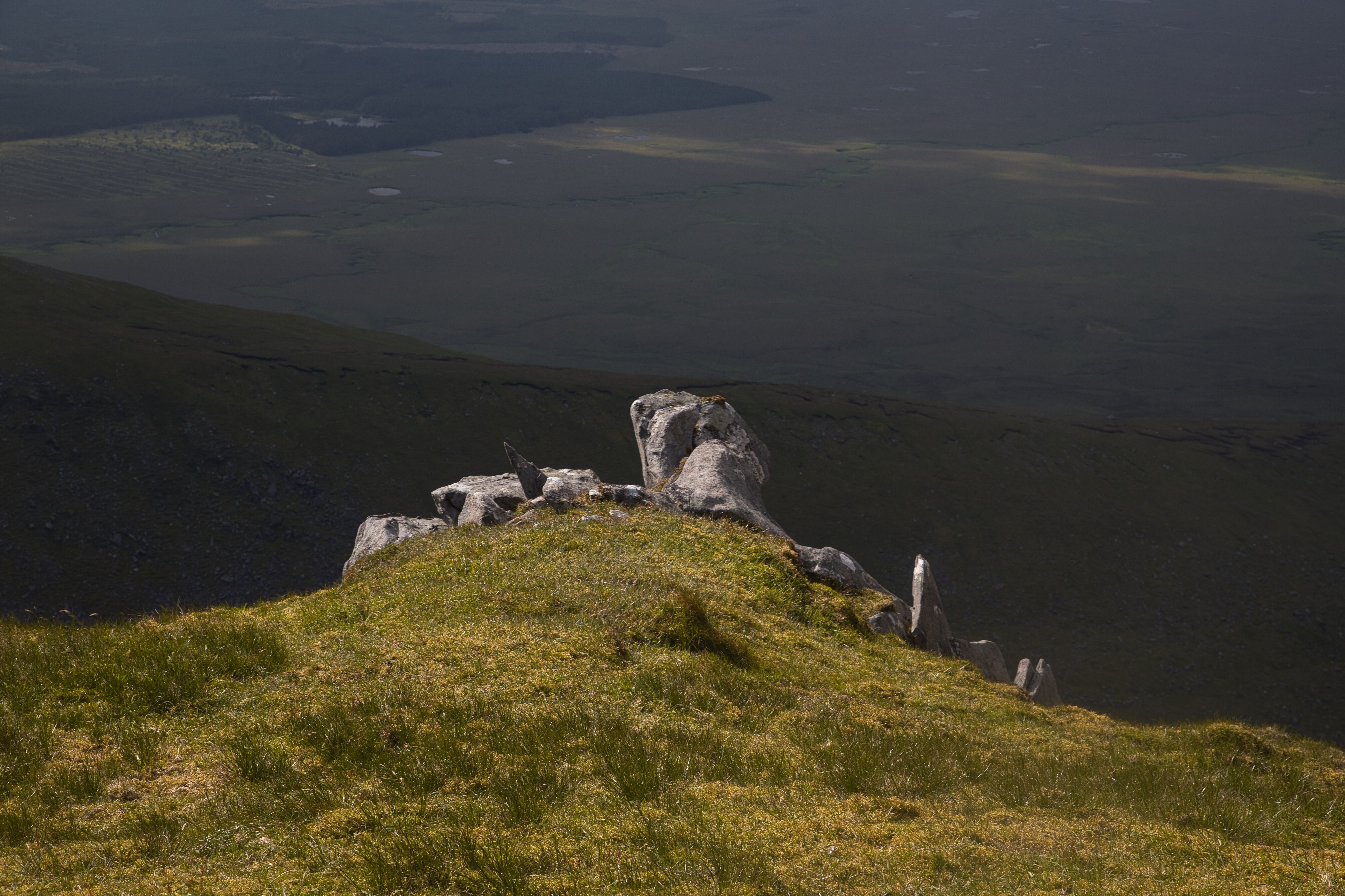
The culmination of my efforts was reaching the summit, marked by a small cairn. From this vantage point, a magnificent vista stretched out before me, with the route extending majestically towards the awe-inspiring Corrannabinnas. As I stood there, taking in the scene, the prospect of venturing forth onto this route sent a shiver of excitement down my spine, a testament to the sheer grandeur of the experience awaiting me.

The small cairn on Glennamong, with the fabulous Corrannabinnas in the background. The route to the two summits is via the narrow ridge line in the middle distance.

Lough Feeagh.
Sunshine catching the rocky outcrops in splendid fashion.
Glennamong to Corrannabinna
Located about three kilometres from the summit of Glennamong, the trek to Corrannabinna presents an exhilarating and challenging journey through an elevation adorned with a few peat hags, patches of loose stone where the bog has eroded, and swathes of grass ideal for sheep grazing. The going was good as the ground was relatively dry.

The start of the Corrannabinna climb is notable because of the narrow ridge and the deep drop on both sides.
Traversing the plateau towards the summit, one is gradually met with the imposing ascent to Corrannabinna. The initial ridge, a little wider than expected, conceals risks as a sheer drop of about 250 meters down to Corryloughaphuil lough looms to the right.

Corryloughaphuil Lough.
The steep climb, sloping off sharply to the left gradually becomes gentler as one ascends higher, eventually leveling off near the top. The final approach to the summit offers a delightful stroll, ultimately culminating at 714 meters, where the summit is distinguished by a trigonometry pillar. From this elevated vantage point, the renowned arête unfolds, offering a truly breathtaking panorama.

The trig pillar on top of Corrannabinna.
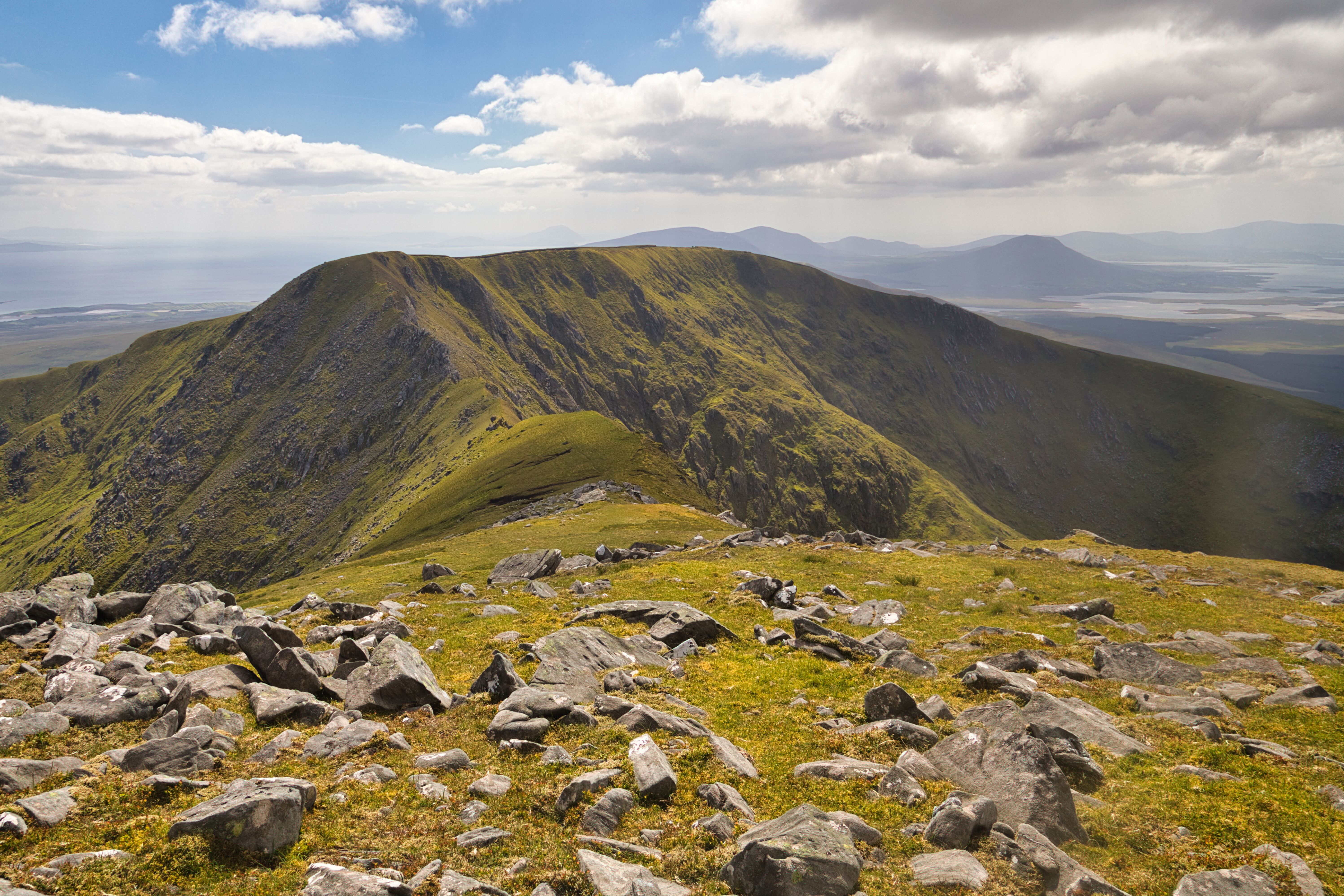
As I reach the top of Corrannabinna, I can see for the first time the imposing natural structure of the Arête.
The summit of Corrannabinna rewards hikers with some of the most splendid vistas in the area, justifying the time and exertion invested in reaching it. The surrounding landscapes and natural beauty are nothing short of awe-inspiring and certainly require ample time to be fully appreciated. The scenery looking south over the Owenduff bog is nothing less than spectacular. It is just as captivating now as the first time I witnessed it from Corslieve when I climbed Slieve Carr a few years ago.

Looking towards Achill over the expanse of the Owenduff blanket bog.

Looking south from Corrannabinna's summit, the Ownduff River winds its way through the bog.
Corranabinnia to Corranabinnia South Top
The scene over towards Corranabinnia South West Top and the imposing ridge line of the Arête.
The most remarkable aspect of this leg of the journey is the arête between the two Corrannabinnas. An arête is defined as a high, sharp ridge separating two glacial valleys, and the one here certainly matches this description. Having never encountered a geographical feature like this on any of my hikes, the thought that occupied my mind was simply how I would cross it.
I noted that in the first part, the grassy bit wouldn't be too bad, but the rocky area would necessitate a bit of scrambling, something new to me. Once over that, it was on to another piece of grassy ground and then up onto the south-west top. All this was grand only for the thought of the two huge drops on each side. To put it in perspective, the highest part of the Cliffs of Moher is 214 meters high at O'Brien’s Tower. Here, the vertical drop is approximately 250 meters on the north-west side and nearly the same on the other, albeit not a sheer one.
So, after a period of deep contemplation, it was time to move on. On a final check of my gear, everything had to be secure: no loose straps, bag tightened up, tripod secured, and a check that my bootlaces were tightened securely. I shook myself; nothing rattled. Good to go!

The challenge of the scramble is yet to come.
I moved down to the green grassy area, locating a worn path and following it to the rocks. I couldn't see a pathway through the rocks, so I decided that the best way was to start scrambling over them near the top. As I started to move along on the rocks, I noticed I was moving slightly down on the slope and readjusted to move back onto or near the ridge where the best going seemed to be. In doing so, I happened to have a look over the ridge and had an OMG moment. Slipping back to a spot I deemed safe, I continued scrambling up along the rocks.
Sightseeing time over, it was time to keep moving and focus on the job in hand. Eventually, getting to the top of Corranabinnia South West Top, I stood and surveyed the route I had just traveled. Delighted with the achievement, I prepared to head down the south spur and then home.

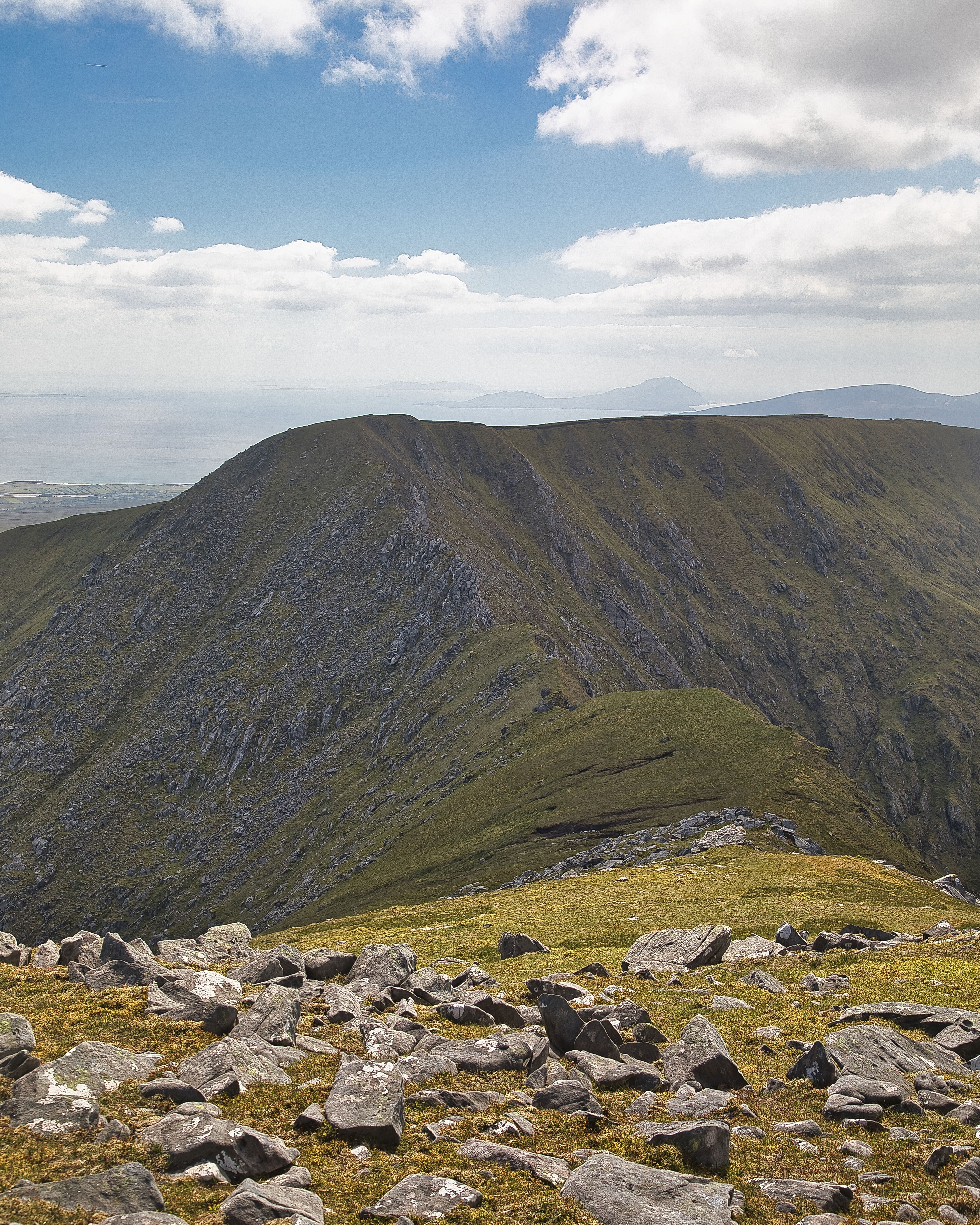
The vista of Corrannabinna and the Arête taken from Corrannabinna South West Top.
Corrannabinna South West Top Descent

The South facing spur provides the way off the mountains
Descending from Corrannabinna South West Top offers a truly stunning experience, with breathtaking views of Croagh Patrick and Clew Bay in the distance. The south-facing spur winds down the mountain and gracefully meets the old bog road before leading out to the main Newport-Mulranny Road.
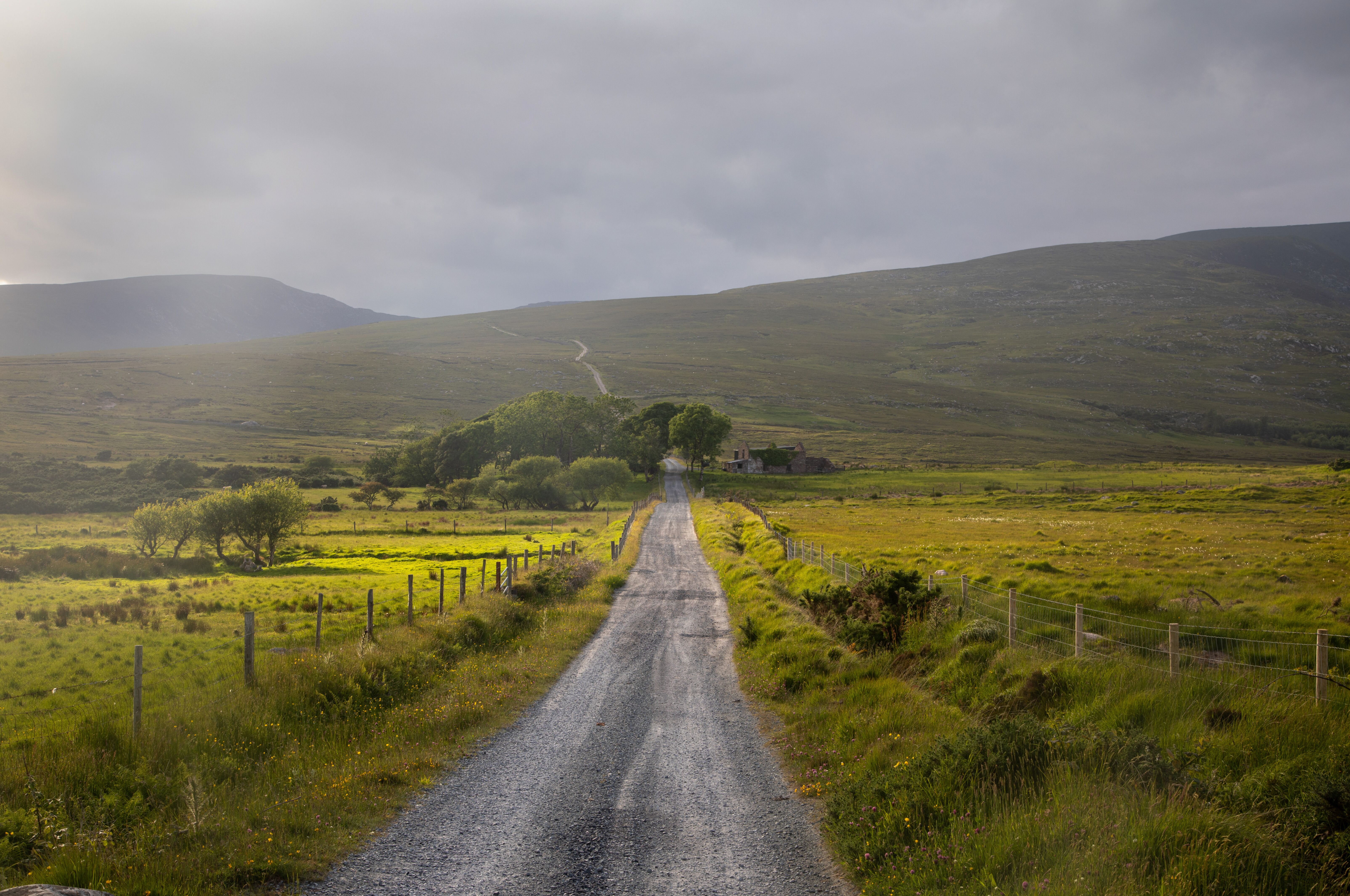
An old house ruin located on the Bog Road
If you plan to undertake this trek, be sure to check weather conditions, pack essential supplies, and adhere to all safety guidelines. This is a journey that promises not only stunning vistas but also a sense of accomplishment that comes with conquering a rugged and beautiful landscape.

The bedrock, which is composed of schist and hard Dalradian quartzite, produces some lovely natural art.