The Partry Mountains, a fantastic view and a surprise find of an unique Waterfall. 💦
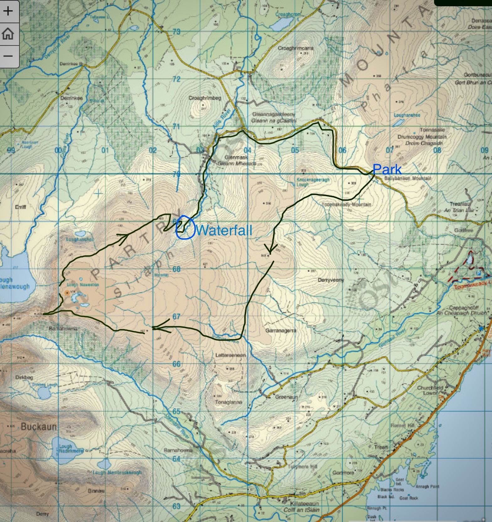
OSI map sheet 38
“It does not matter how slowly you go as long as you do not stop.”
Confucius
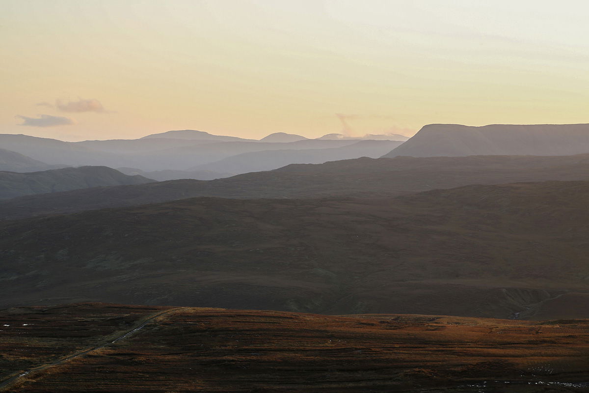
In the distance, the view of Maumtrasna plateau's characteristic shape really stands out.
If you have a preference of hiking through acres of wet peat and stoney landscape then the Partry Mountains is the place for you.
Wanting to explore this vast plateau I parked my car on a small lay-by on the Tourmakeady to Glenmask road. This is the mountain road that brings you across the Tourmakeady mountains onto the main Westport, Leenaun road, N59.
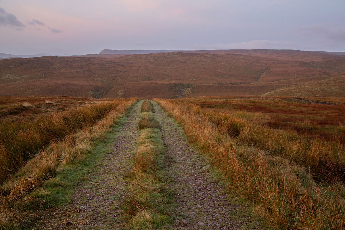
The trek begins on a gravel path that leads into the large boggy area of the Tourmakeady mountains.
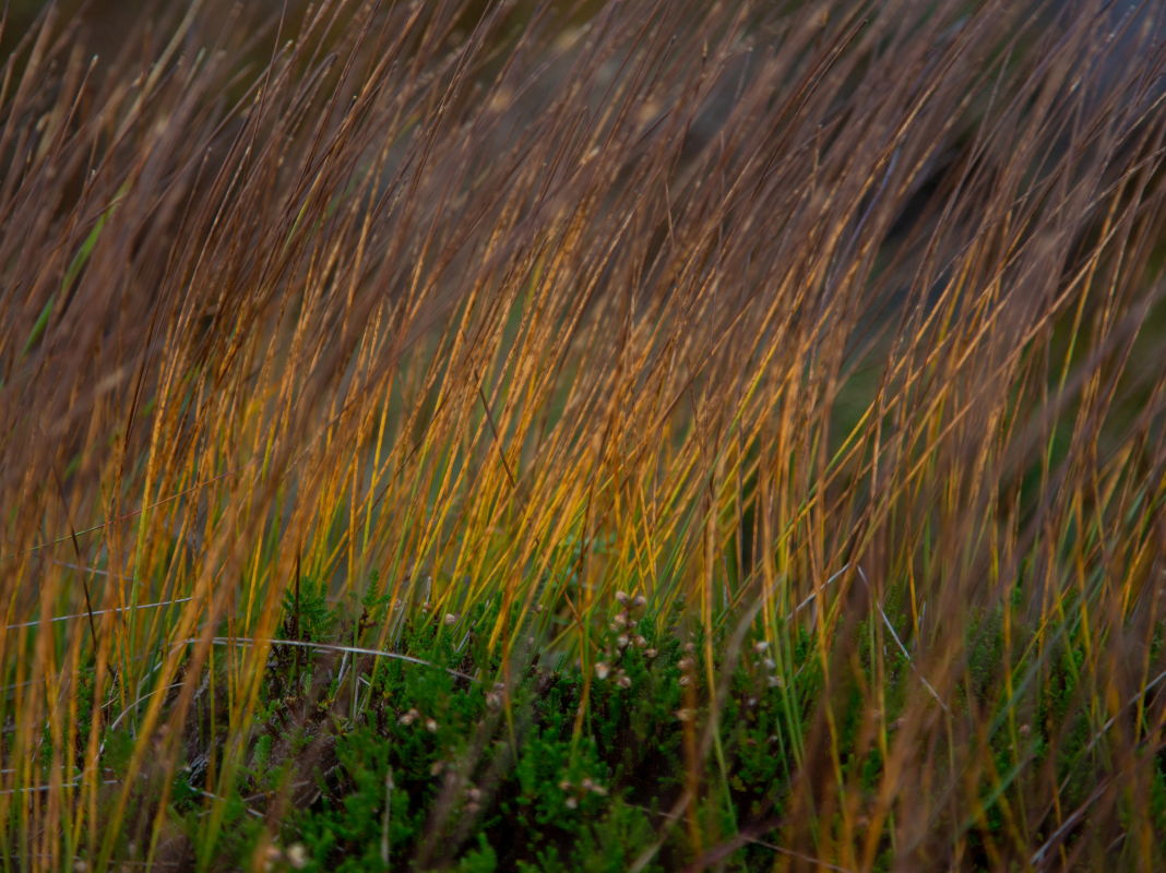
Various sedge types give the landscape a red brown rustic colour.
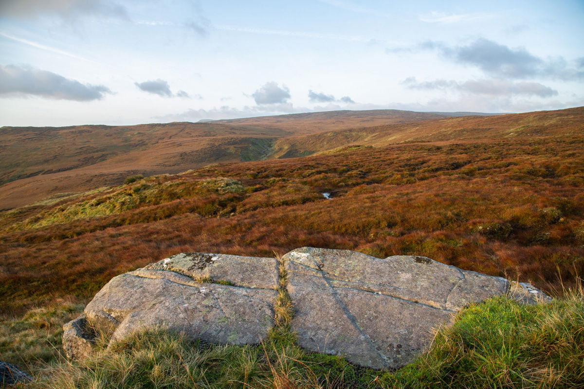
The beautiful red brown colours of the landscape.
I began by following the bog road into the mountainside before heading west via the various spot heights to the Maumtrasna mountain range. My mission was to acquire a stunning picture of Lough Glenawough from a natural geographical land bridge feature that connects the two large Partry mountain plateaus together i.e Maumtrasna and The Partry Mountains.
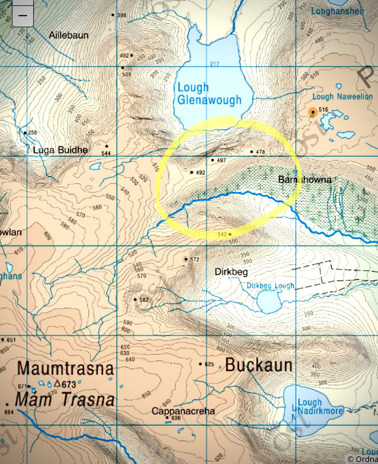 The “Land Bridge” at Lough Glenawough
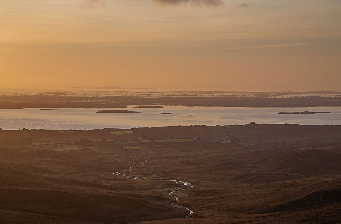
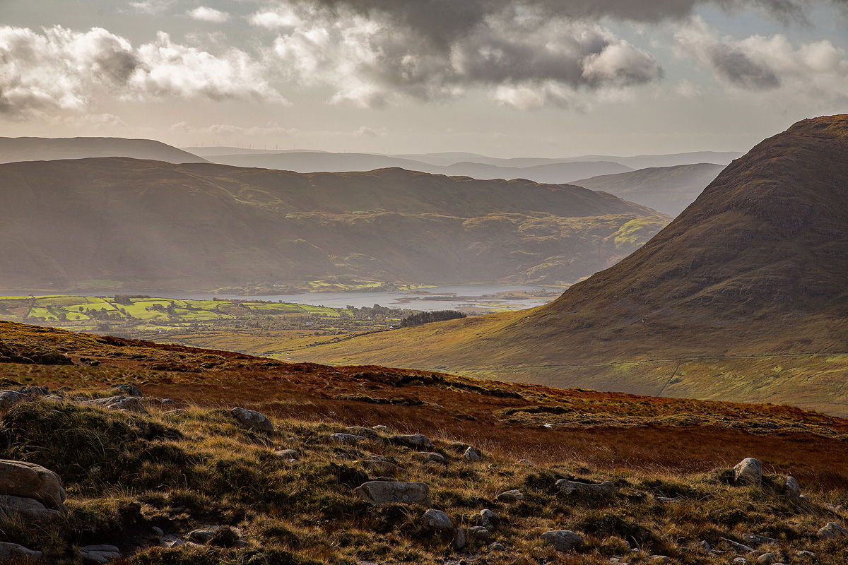
Heading into the plateau early in the morning, Lough Mask and some fog banks further afield can be seen towards the south east.
Not much can be said about the arduous trek in other than the fact that the ground was significantly more soggy than it had been earlier in the year. It was satisfying to ascend further onto the plateau, where the landscape transformed from muck to stones and granite. You don't fully appreciate how amazing this site is until you get to the edge of the plateau and see the gorgeous Owenbrin valley spreading out in front of you.
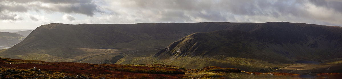
The great Maumtrasna mountain range Showing the prominent Buckaun spur.
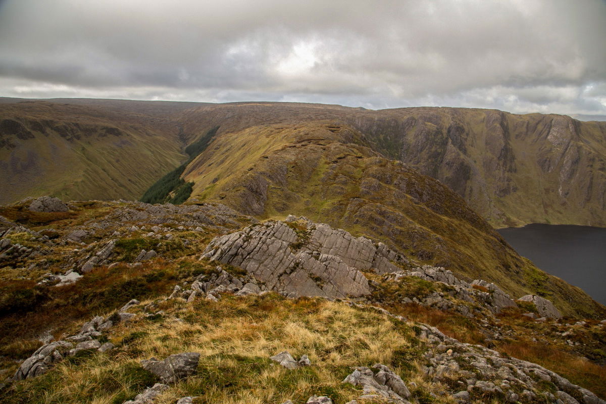
The piece of land joining East and West Partry mountain land plateaus looking towards Maumtrasna.
Standing at 467 meters, I can see the piece of land linking the two land masses, and as I head for Lough Naweelion, which at 516 meters is the highest point on this section of the trek, there are terrific views of the Owenbrin river from all along the valley's edge.
looking down towards Glenbeg East.
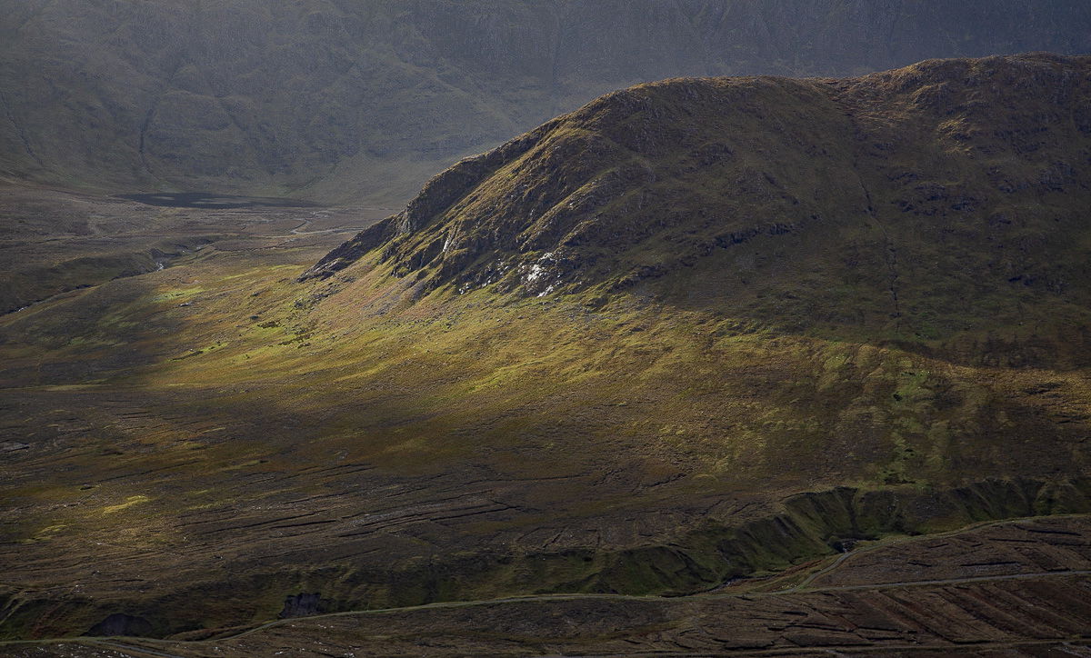
The Buckaun Spur with the Owenbrin river in the foreground.
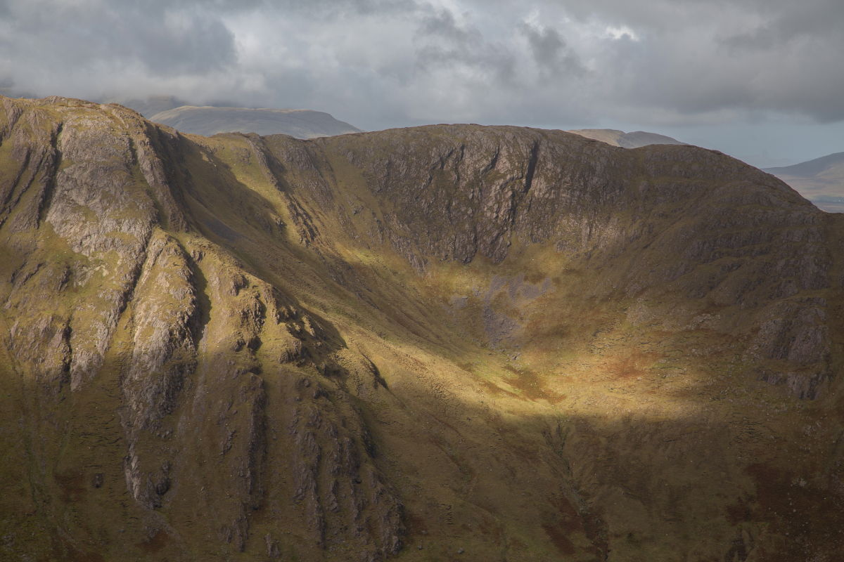
Lough Glenawough gently comes into view as I reach the north-west corner of the Partry mountain plateau. What a view I have from here, and it’s well worth the lengthy trek in here to see it. Looking out over the lake, I can see Croagh Patrick in the distance and the mountains of North Mayo behind.
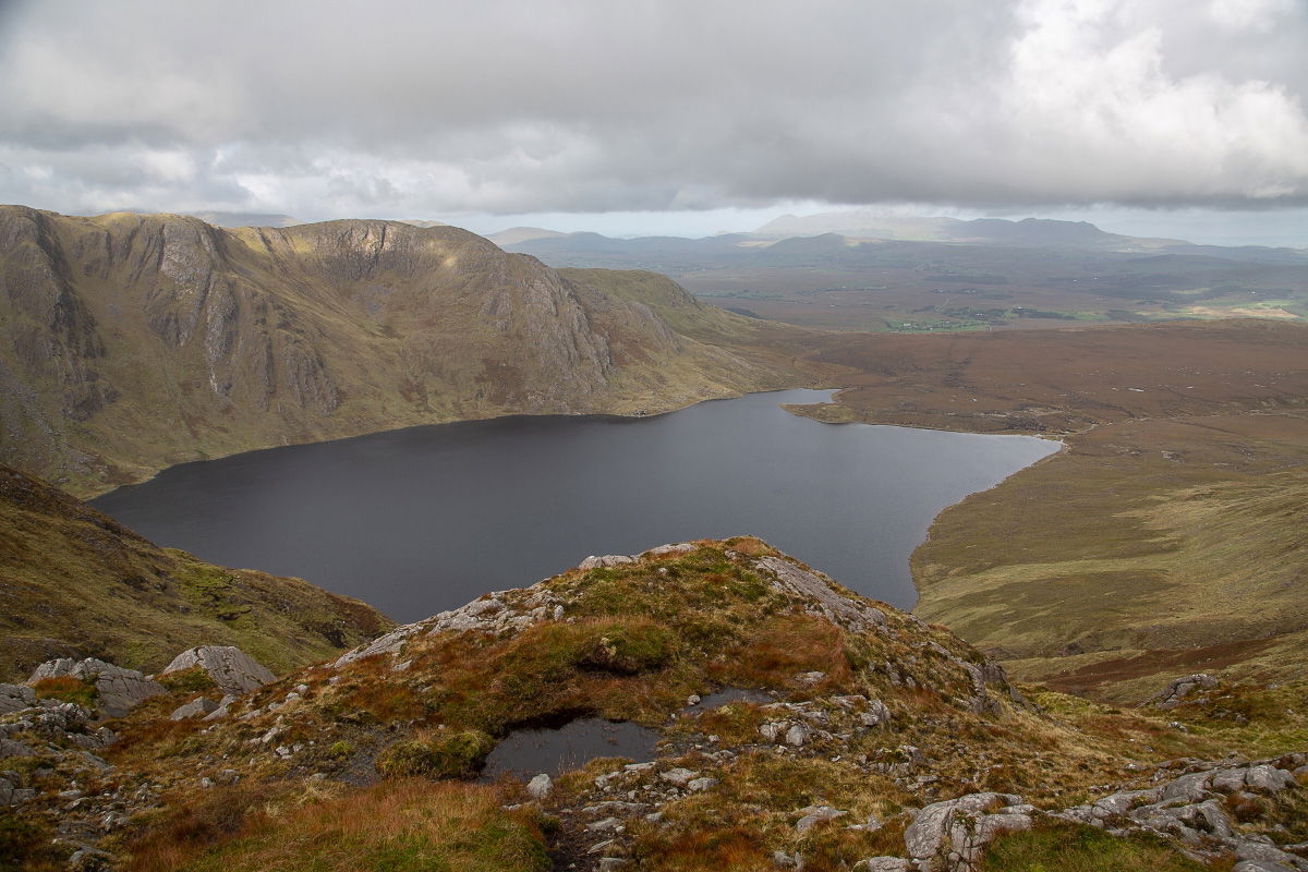
Lough Glenawough with Croagh Patrick in the distance.
Close up shot of the western cliffs of Lough Glenawough.
Low clouds are forecast later, and if that happens, I'd want to be a little lower, so it's time to leave the mountain and return to the starting line. My aim is to descend along the plateau's left side, then join and follow the Aille river until I reach a public road that will take me back to the car. The Aille River rises here and drains the northwest part of the Partry range of mountains before sinking underground at the Aille Caves. It continues as a subterranean river for 4 km, resurging at Pollatoomary. It flows south to Cloon Lough, which feeds into Lough Mask.
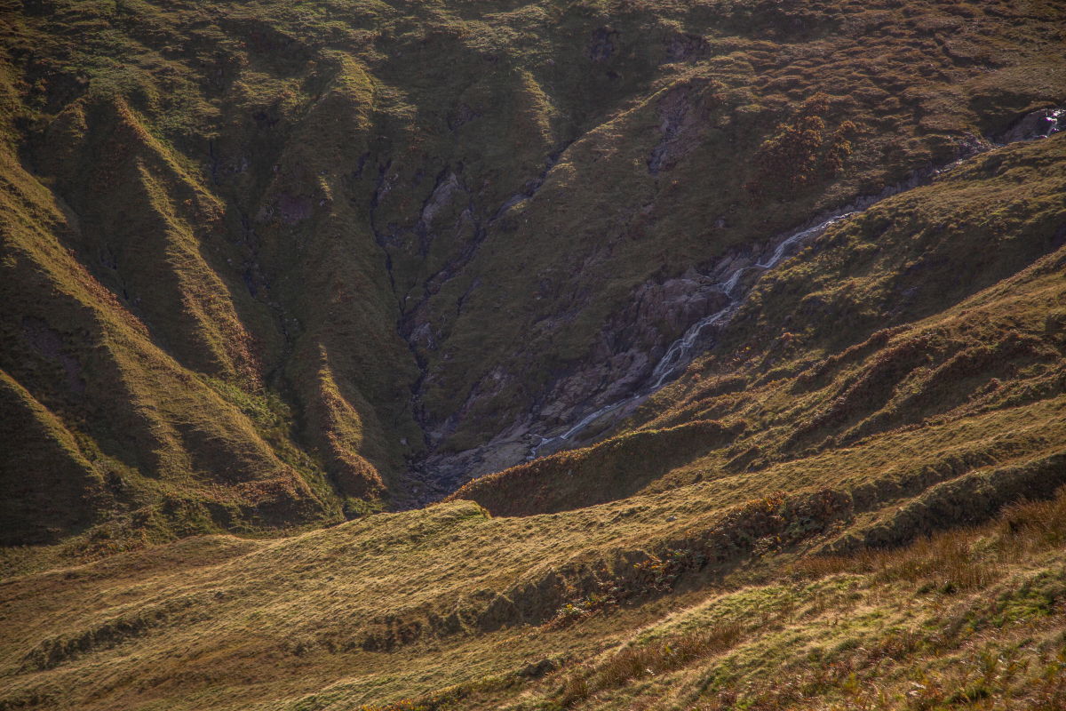
On the top of the valley looking down into the source of the Aille river and seeing the waterfall.
When I got to the river valley, I noted that it had a decent flow. But, maybe more crucially, I observed that the river's source had a waterfall. I decided I wanted to go down there to see what it looked like since I thought there might be a good photo opportunity.To say the least, getting down into the valley was dangerous, but as I approached the waterfall, I could see it had a lot of promise for a fantastic photo. Finding this waterfall tucked away in a small section of the Partry mountains was absolutely unexpected, and that, combined with the fantastic view of Lough Glenawough earlier in the day, made this a very pleasurable and memorable excursion.
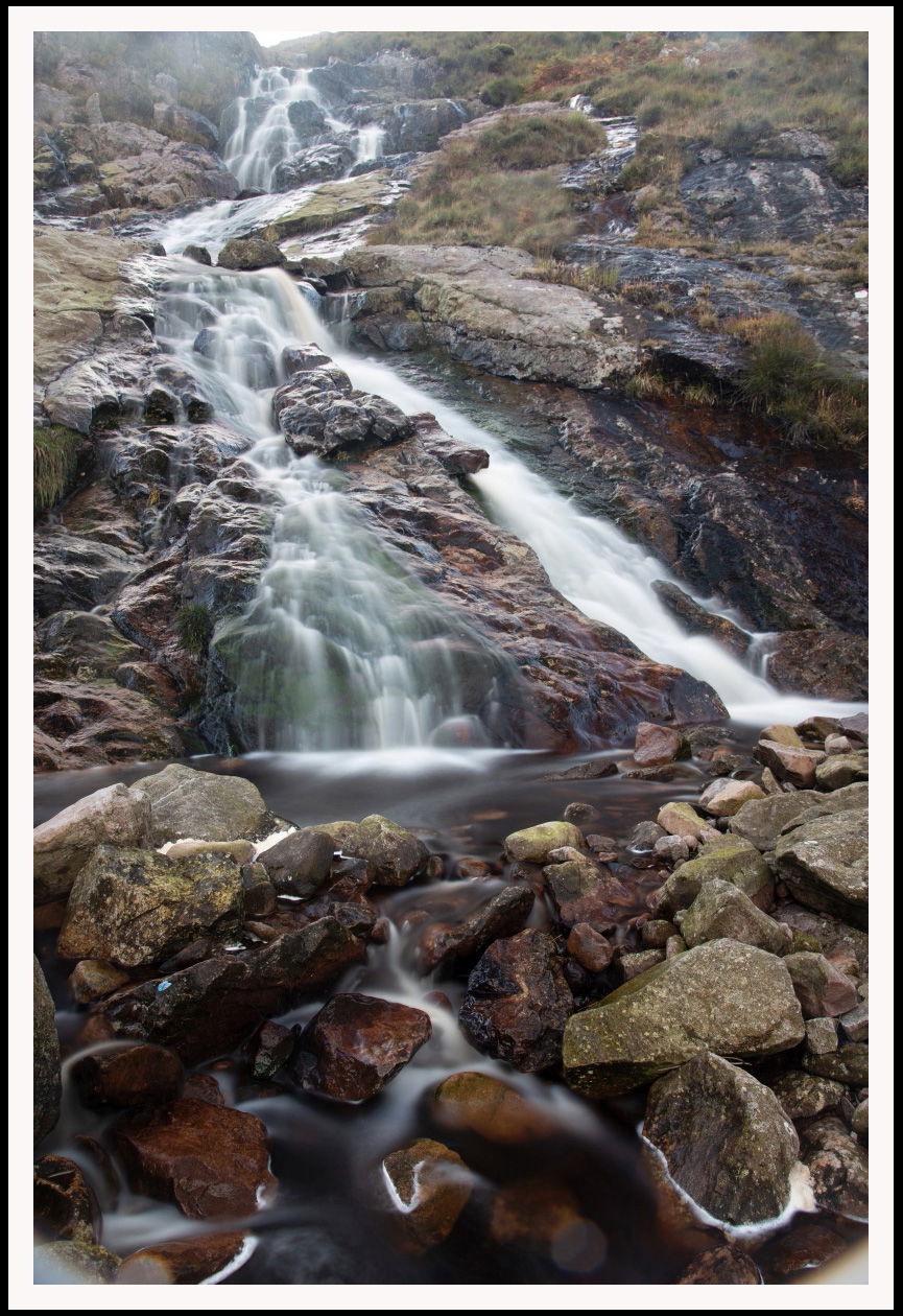
The waterfall at the source of the Aille river.
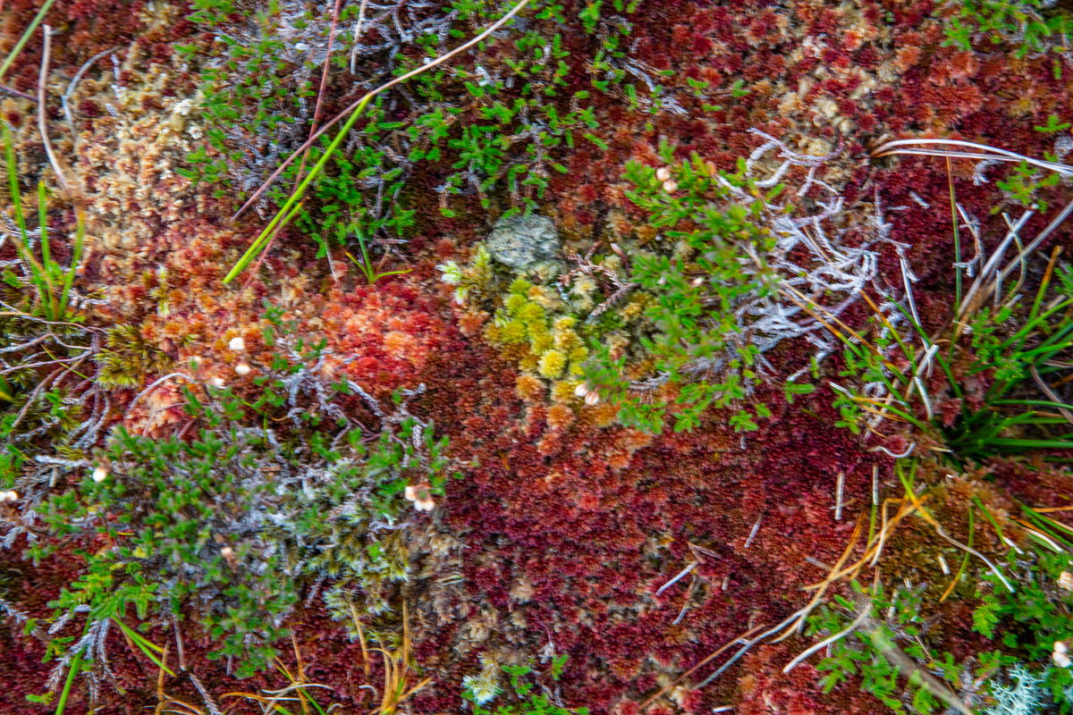
Sphagnum carpets on wet peat made up of of heather, sedge, moor-grass, and cottongrass are dotted all over the Partry mountain landscape displaying wonderful colours.