The 3 Lugas of Maumtrasna and a famous “Field” ☘️

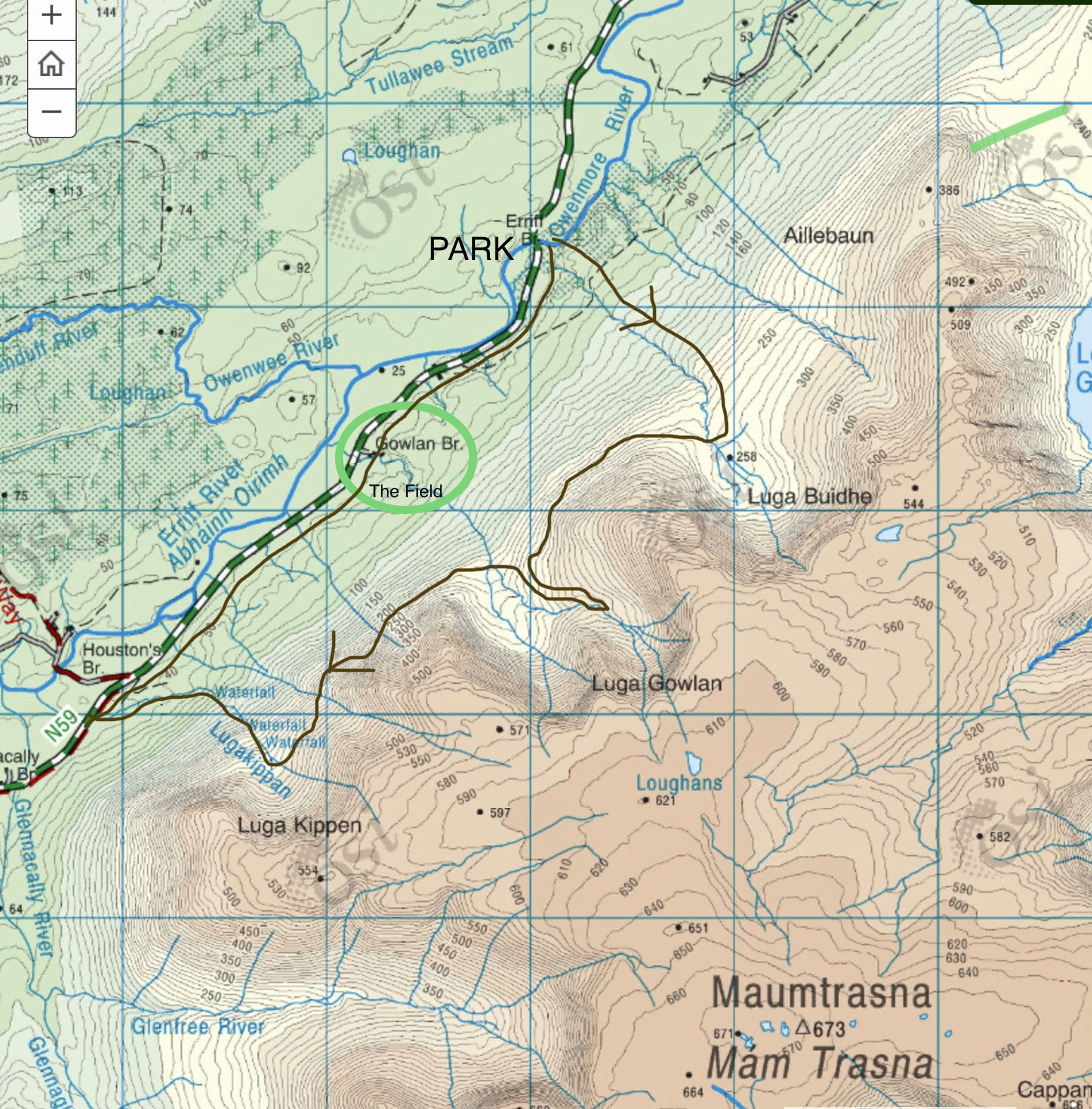
OSI 38
“The world reveals itself to those who travel on foot.”
Werner Herzog
With an extent of slightly under fifty square kilometres, Maumtrasna is perhaps Ireland's largest single, separate mountain. It is one of the best places in Ireland to see corries and related upland glacial erosion structures, and the fact that there are so many and of all sizes in such a short space emphasizes how significant it is as a "corrie landscape”.
Three of these glacial corries—Luga (Irish for "hollow"), Buidhe, Gowlan, and Kippen—can be found on the north face of Maumtrasna, and I think they are worth the hike to try and get a closer look at and check out whether there is anything interesting to see in them.
Luga Buidhe (Yellow Hollow)

The view towards Luga Buidhe as you approach the lip of the corrie is made up of mostly yellow-brown vegetation, which is probably how it got its name.
This walk begins at the lovely little oak wood at Erriff Bridge, which is located at the foot of the Partry range of mountains. The whole of the northern slopes of Maumtrasna can be viewed once out at the top of the woods. I ascend to Luga Buidhe, my first objective, by following the Corrie River straight up the slope until I reach it at about 250/300 metres.

Looking down towards Erriff Bridge and the yellow shed house with the distinctive red door!

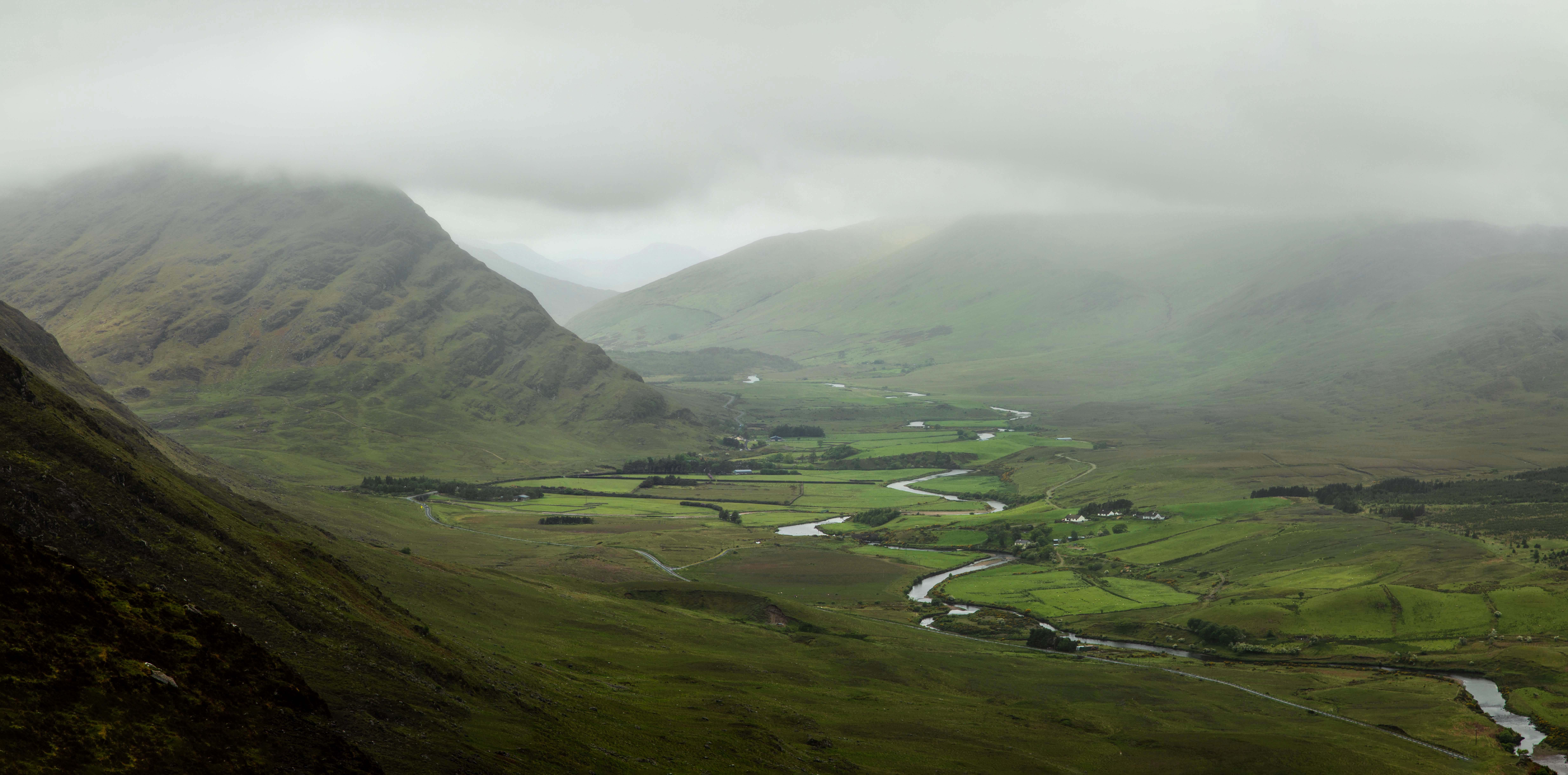
The Erriff River meanders off into the distance through its valley to join the sea at Aasleagh Falls.
Luga Gowlan (Hollow of the small fork)
From Luga Buidhe, it's about an 800-metre traverse hike across rough grass and rock to get to the front of Luga Gowlan. Luga Gowlan gets its name from the fork in the Erriff river near Gowlan bridge. As Luga Gowlan has a double Corrie, a bit more effort is needed to climb higher to get a good look into the Corrie at the back

The rear Corrie is high and on the left of Luga Gowlan.

The two corries are side by side, separated by a high spur in the middle, showing the difference in height between the two.
Peering down into the large Corrie, I notice that there are three mountain ash trees growing near the stream and I decide to go down and investigate. After a closer look, I find that the trees are perched on a lovely waterfall.

The Mountain Ash - Rowan tree
The Mountain Ash or Rowan is a small tree that grows to about 15 metres high and is commonly found in glens, by mountain streams, in woods, and in rocky places. It bears large, flat heads of numerous creamy-white 5-petalled flowers in May and June, and these heads become the familiar clusters of red berries in autumn. The distinctive ash-like leaves are green on both sides, pinnate, and have up to nine pairs of oblong, toothed leaflets. This is a native plant, and it belongs to the family Rosaceae.
The Field
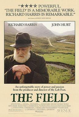
The 1990 Irish drama film The Field, starring Richard Harris, John Hurt, Sean Bean, Brenda Fricker, and Tom Berenger, was written and directed by Jim Sheridan. The movie, which is set in the early 1930s, was nearly entirely filmed in the Connemara community of Leenaun.

The Field is an adaptation of the hit John B. Keane play. A farmer, the Bull McCabe (Richard Harris), has toiled for years over rented land from a widow (Maggie Butler), only to suddenly fear losing it as the widow puts it up for auction. Intimidation and mayhem ensue to rid off any potential competitors for the purchase of the land.

The farm, which is located next to the Westport-Leenaun main road, N59, is photographed from Luga Gowlan, and you can see the real field that was depicted in the movie in the middle distance, just in front of the white cottage.
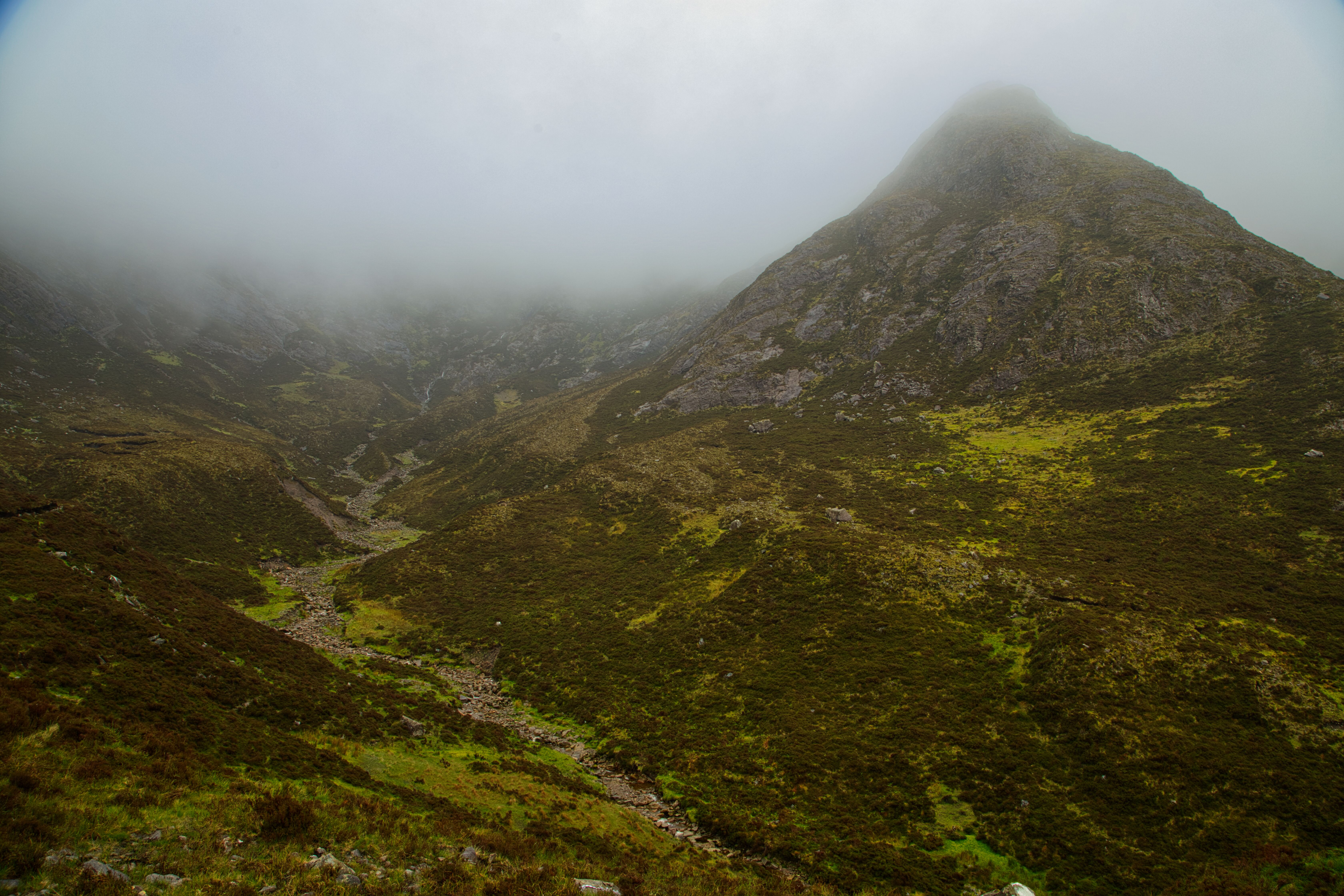
Compared to the first part of the hike, from Buidhe to Gowlan, the Luga Gowlan trek over to Luga Kippen proved to be more difficult. I had to descend to an area of approximately 200 metres where the walking was easier because the slope was less steep. Thus, in order to enter the Corrie when I got closer to Luga Kippen, I had to climb back up over the steep rocky incline. I discovered on arriving here that the entrance to this corrie, the smallest but highest of the three, was enhanced by another lovely waterfall. One can only imagine how much water flows through these waterfalls and gullies during periods of exceptionally severe rain.

Another lovely waterfall can be found at the Corrie's entrance.
Luga Kippen (Hollow of the Chip)

The term Kippen has the letter K, which is unusual for an Irish place name, making it difficult to investigate its meaning as the letter K does not exist in the traditional Irish language. "Kippen," or maybe "Chip," means a small piece of something removed in the course of chopping, cutting, or breaking a hard material such as wood or stone. With the large amount of stone in and around this corrie, one could easily lean toward this explanation.
On the other hand, the word "Cipín" which in Irish means to gather sticks and stones, is another possible origin for the name and is close to the explanation given above.
However, while looking at an old Geological Survey of Ireland map dated 1874, I noticed that the name marked on the map for Luga Kippen is "Lugathepin". That looks like an entirely different meaning from the word "Kippen", and one I couldn’t get any explanation for at all.


It's time to head back to the car via the N59, which I was close to throughout the entire hike. Care must be exercised here, as following the Lugakippan stream down a rather steep slope comprised of rough stone and slippy bog can be dangerous. It takes roughly 2.5 kilometers to return to the car once I'm back on the road.

Tawnyard Lough and Derrintin Lough viewed from the slopes of Maumtrasna.
When I look back on this hike, I would say it was, to put it simply, a fascinating day. The opportunity to capture images of two remote waterfalls that few people get to witness was great. We are fortunate to live in this area, given the beautiful scenery that surrounds us!
Carpe Diem