Hiking Through the Past: Exploring some of the the Ancient Settlements of Achill Island on this St. Patrick's Day ☘️ 🇮🇪
“Old houses, I thought, do not belong to people ever, not really, people belong to them”.
Gladys Tabor
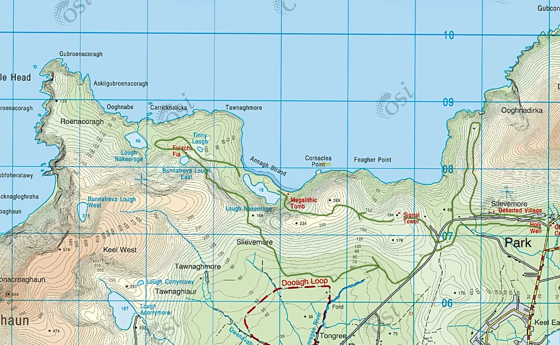
OSI 30, North Achill.
This St. Patrick's Day, I wanted to break away from the typical celebrations and dive into the heart of Irish culture and heritage. My destination? The breathtaking Achill Island, a hidden gem that offers a rich tapestry of history and stunning landscapes. I set out with a specific goal in mind: to visit and uncover some of the ancient Booley settlements nestled in the remote, less-travelled areas behind Slievemore and Croaghaun mountains and hopefully learn a bit more of our hidden past.
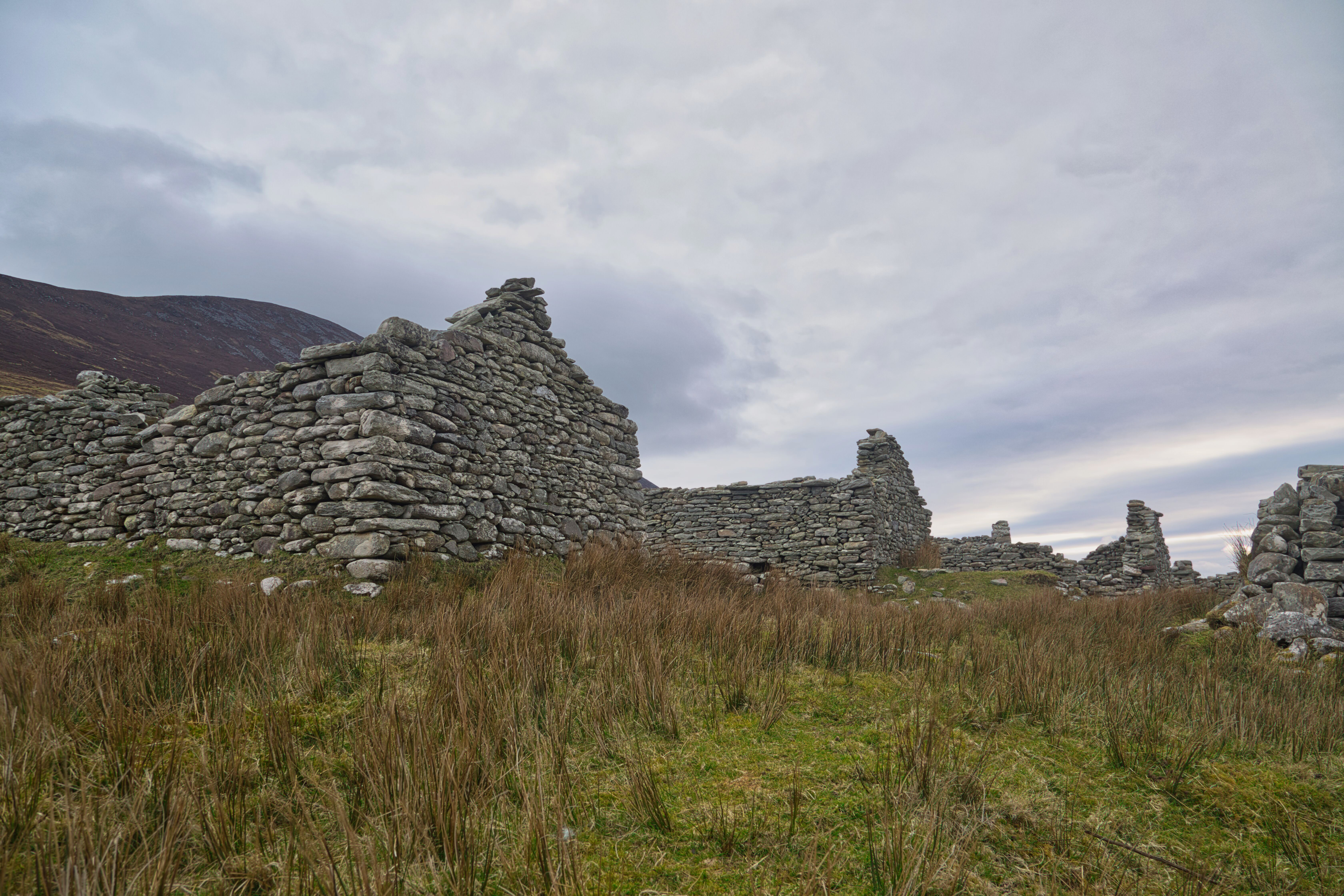
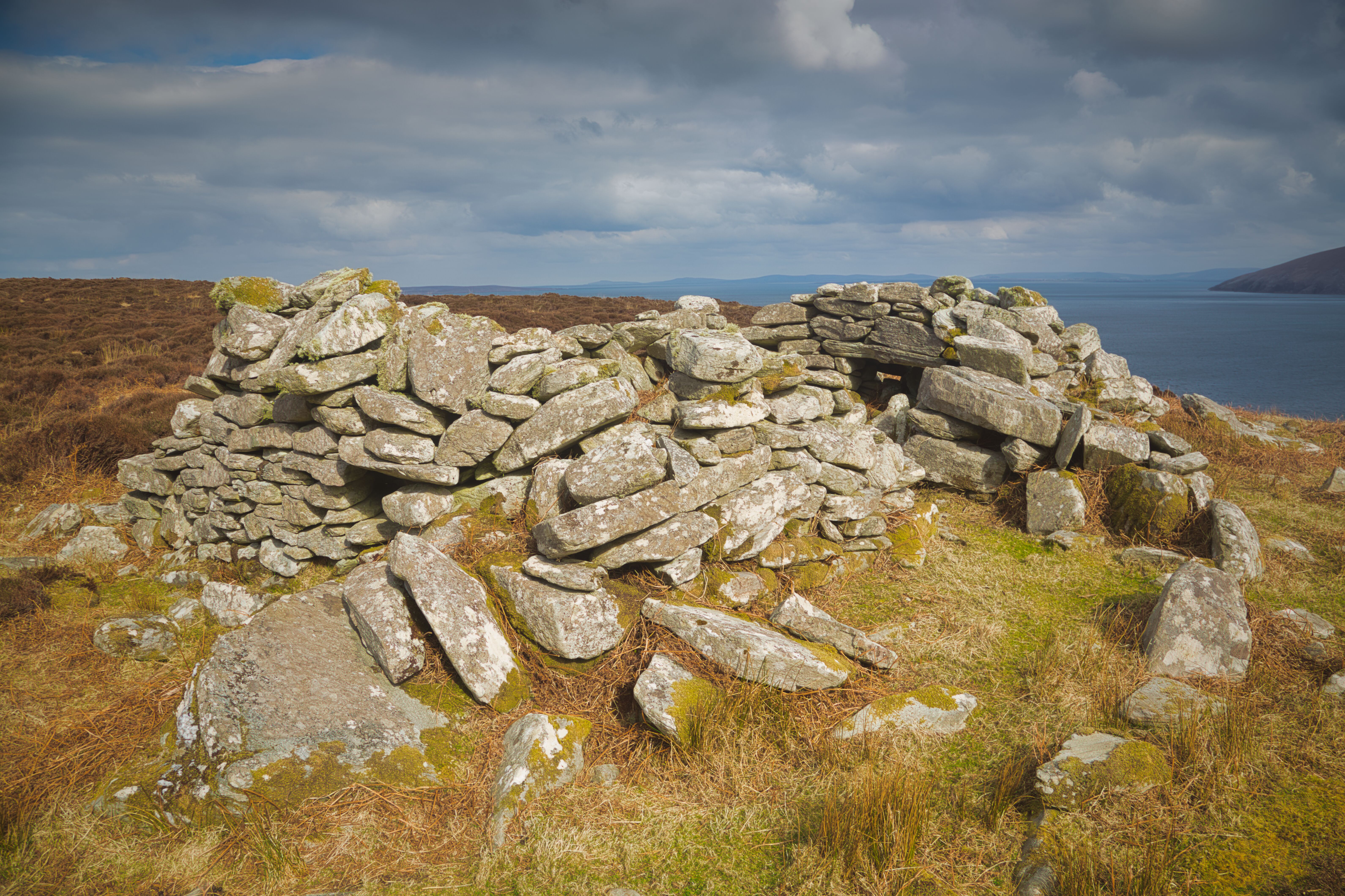
The Deserted Village in Slievemore, Achill Island.
Arriving at the cemetery near the deserted village, this spot serves as a perfect starting point for the trek ahead. The deserted village which always impresses, consists of the iconic Boley houses, which once hummed with life as they were part of the transhumance practice. For centuries, these simple dwellings provided shelter for livestock and their caretakers, facilitating the seasonal movement of cattle to the lush high pastures on the sides of Slievemore. However, with advancements in farming methods, these houses fell silent, abandoned as agricultural practices evolved over time.
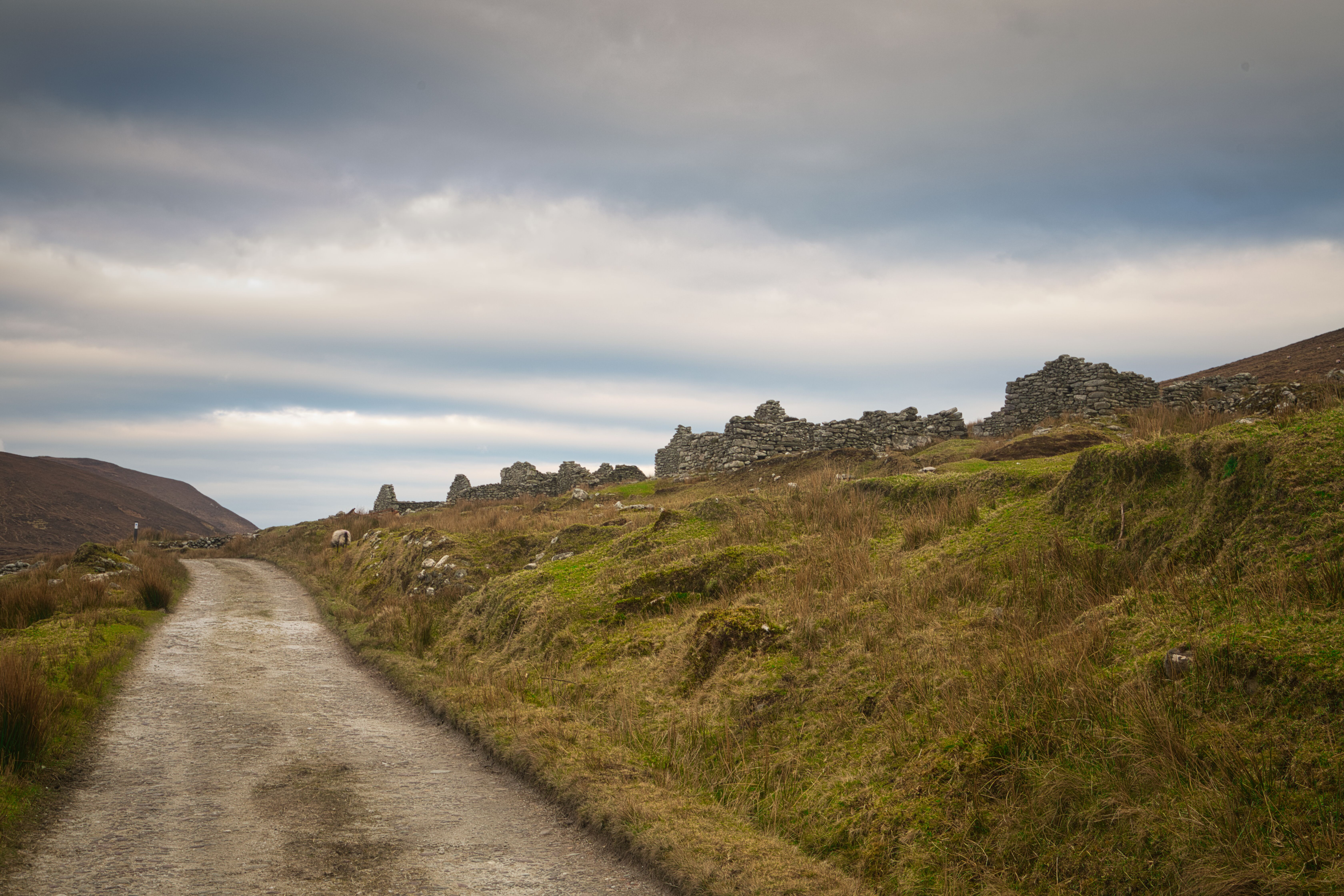
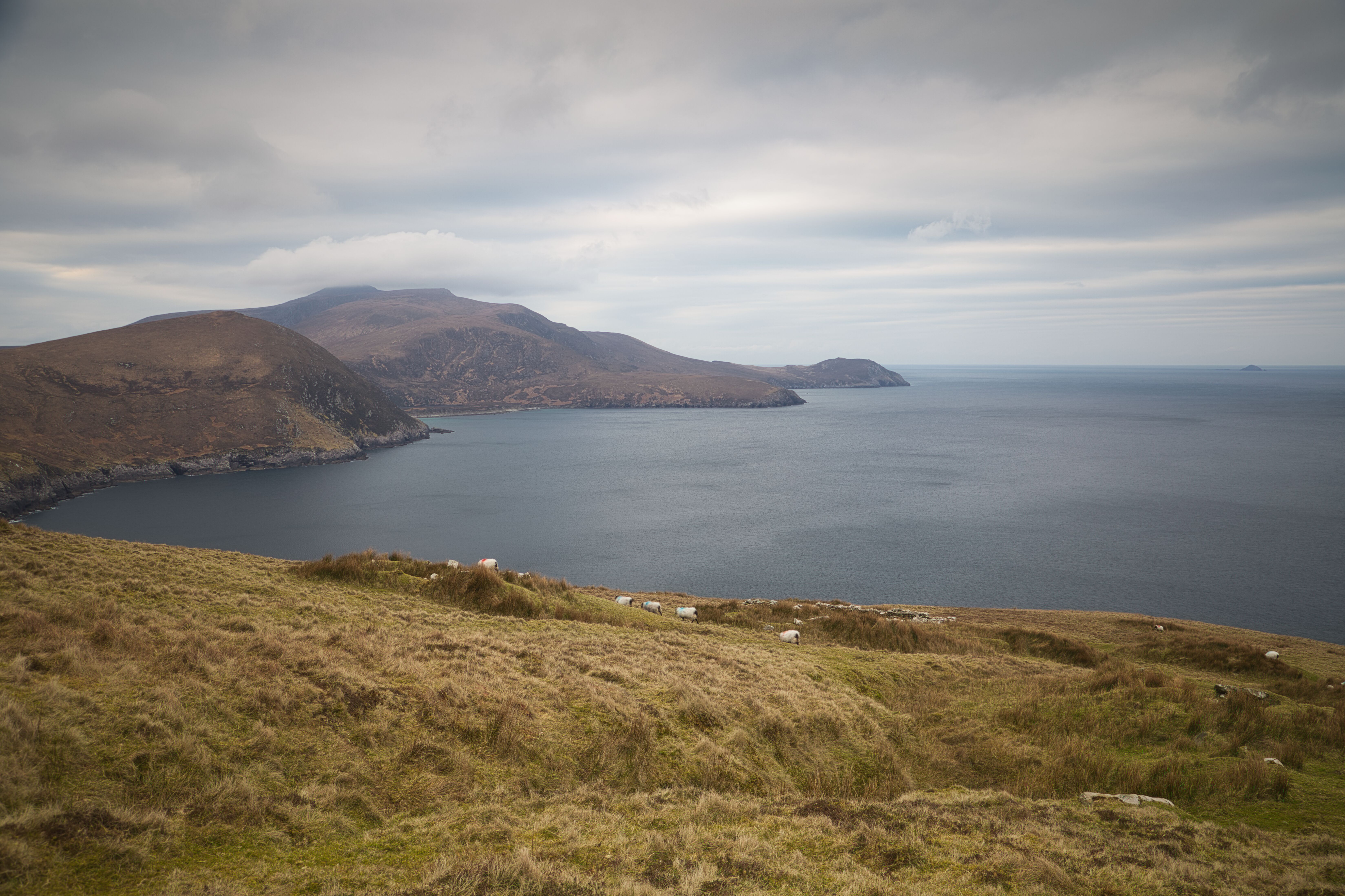
Walking from the The Deserted Village towards Croaghaun along the old route.
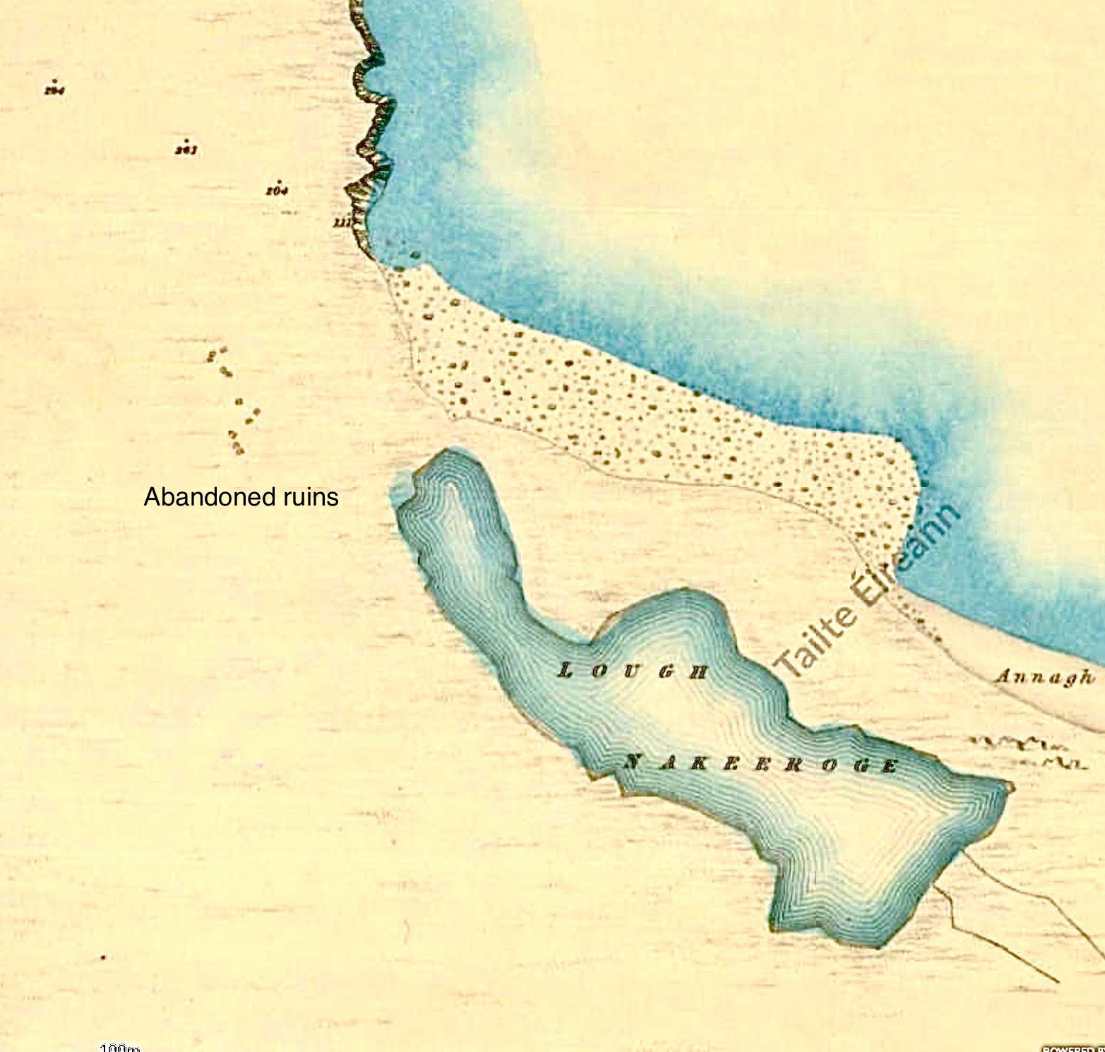
The old historic maps contains a wealth of information not readily available on modern ones. Here this map shows the old Slievemore village with the cluster of houses I’m heading to, towards the north. This old village known as Dirk is close to a location known as Ooghnadirka. (Oogh=Cove).
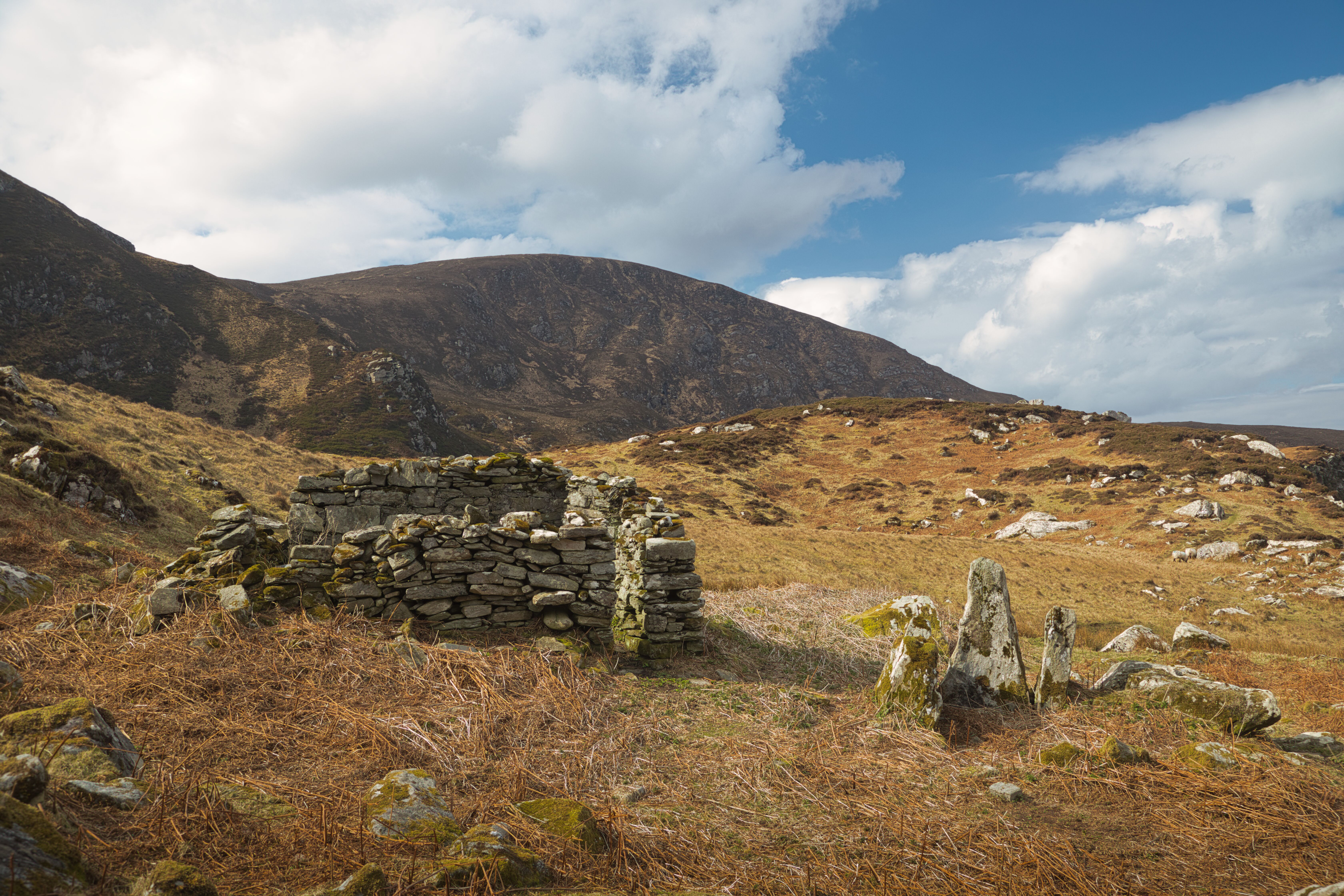
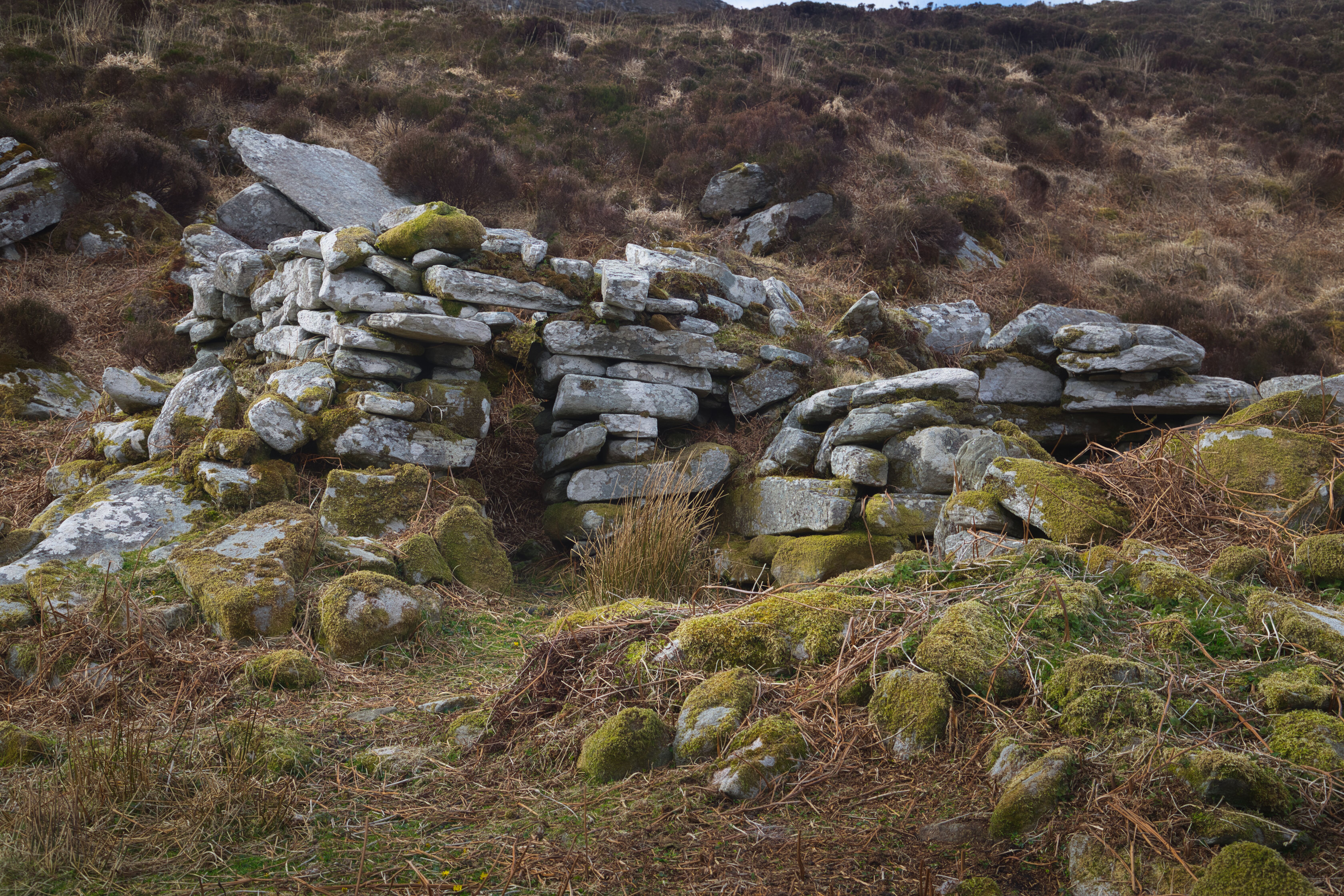
As I embarked on my hike, my sights were set on another cluster of ruins about two kilometres in on the western slopes of Slievemore referred by locals as “Dirk”. According to the historic maps from 1829 1834, a cluster of about twenty or so Boley houses had once thrived in this spot. Although little remains today—only faint outlines of structures and a discernible solitary enclosure—this serene and isolated location offers a glimpse into the past.
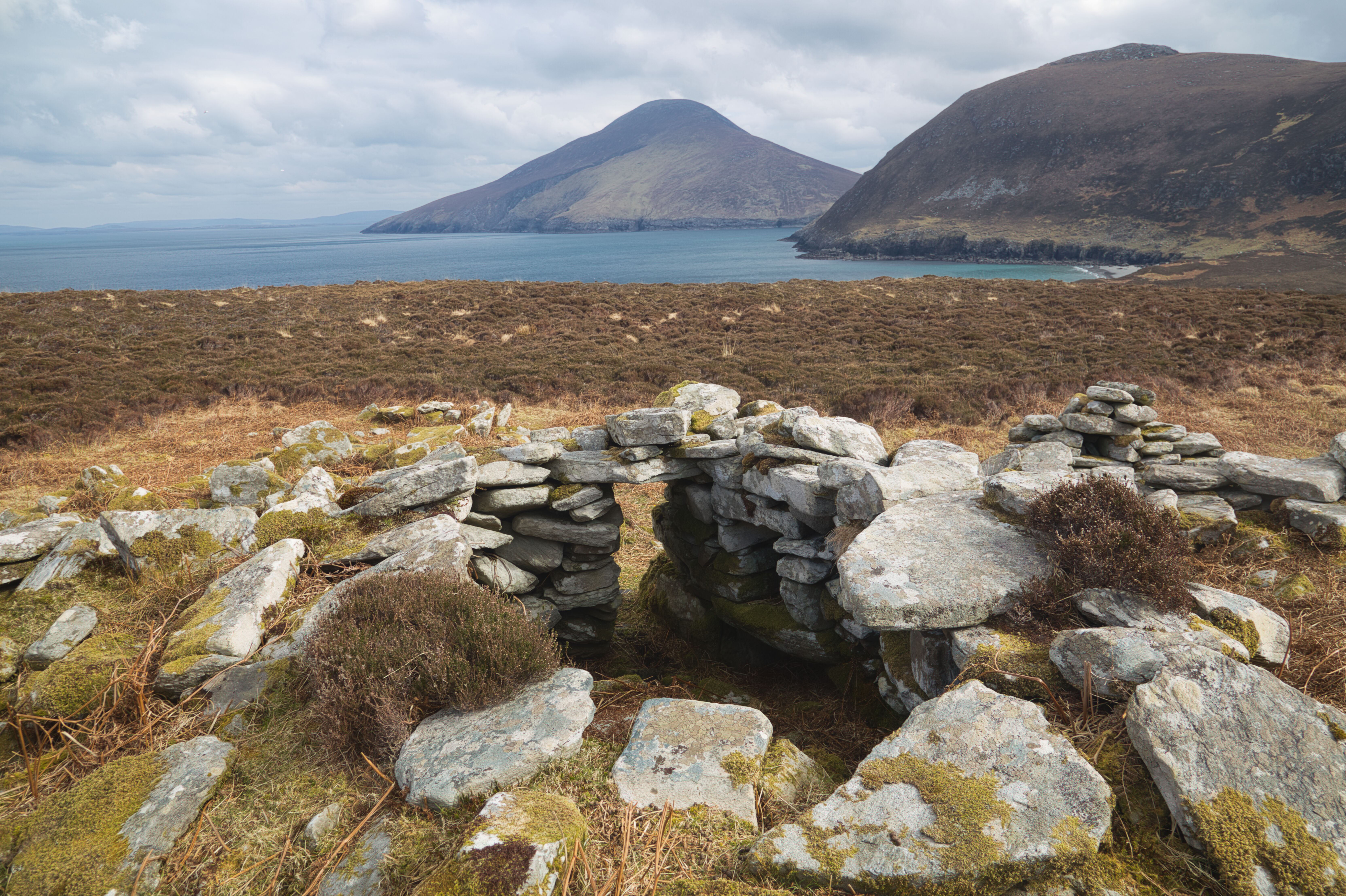
Looking towards Croaghaun from the old ruined Village.
The views from here are simply spectacular, with rugged landscapes of Croaghaun mountain and Achill Head and fine views stretching far out into the Atlantic Ocean to Blackrock* creating an undeniable connection to the land's history.
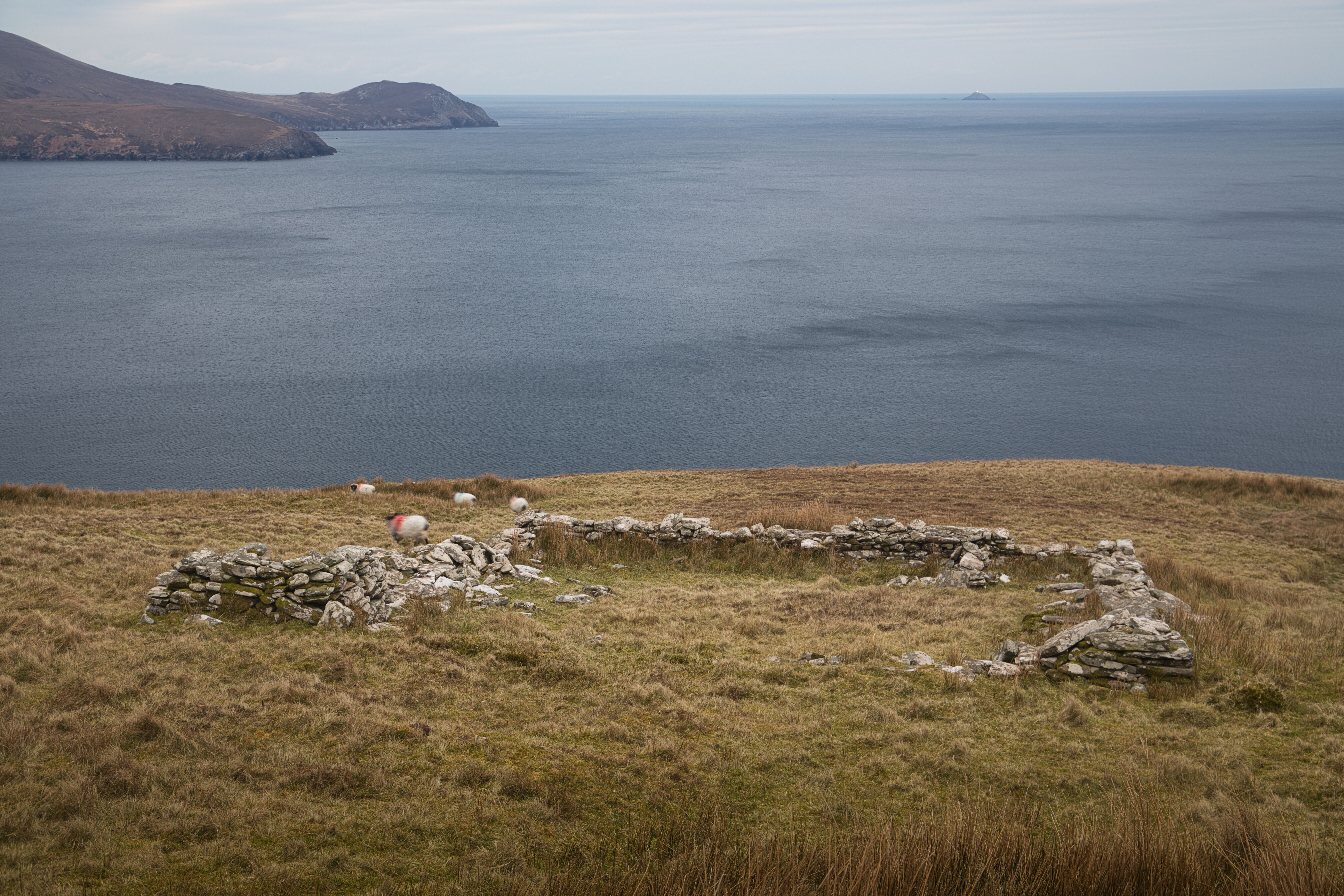
These stones are all that’s left of a sheep or cattle pen.
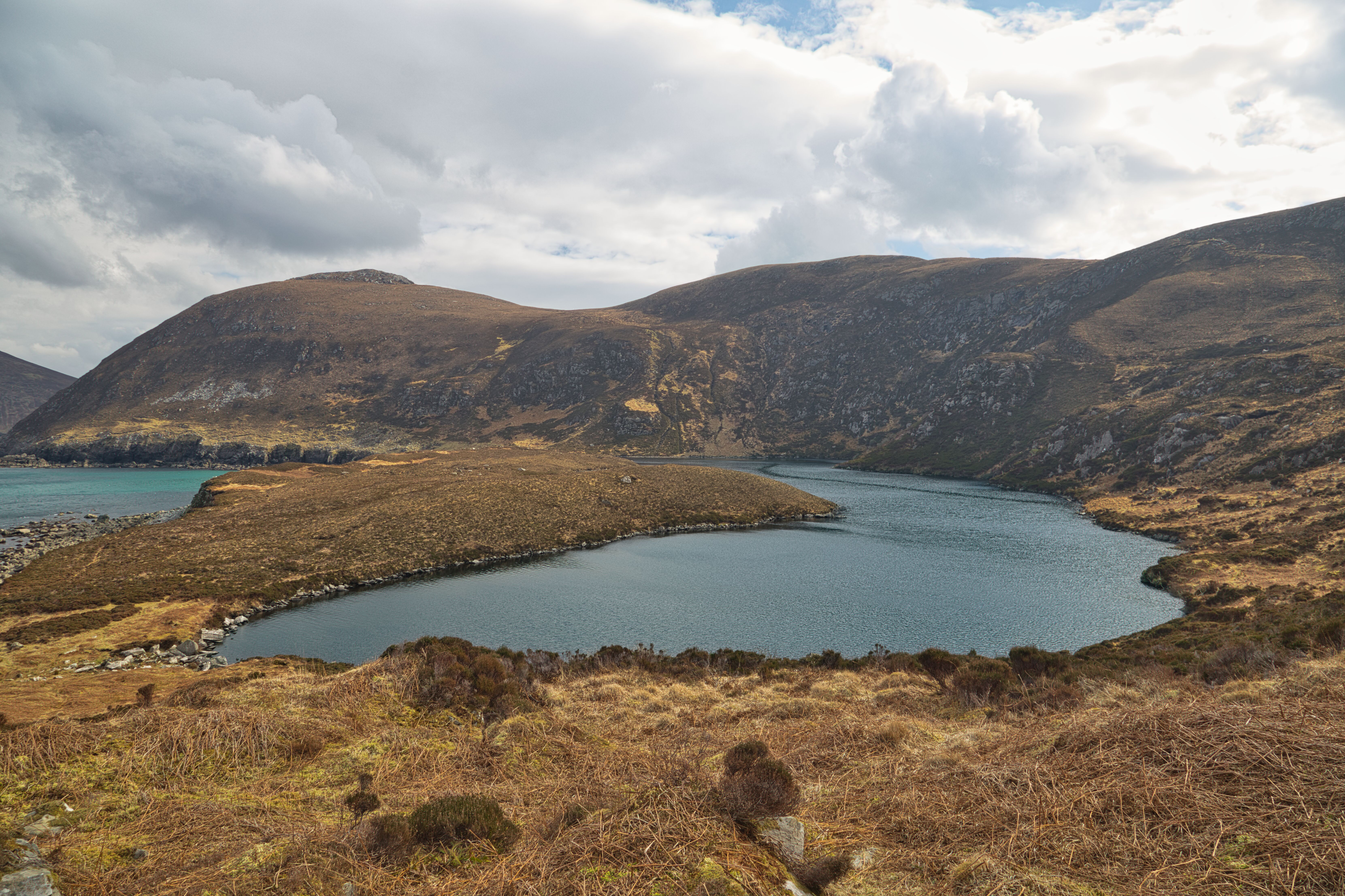
Nestled between the glittering sea and the towering hills of Croaghaun is Lough Nakeeroge, a hidden coastal marvel that offers an enthralling blend of ancient lore and natural beauty. To get there, I have to go via Napoleon's signal tower on hill 194 and I always wondered when visiting this area why this tower was never built on the next hill beside it, which is 75 metres higher at 269 metres and has a much better view out to sea! These towers dotted around the Irish coast were built between 1802 and 1804 to defend against a French Invasion. This threat diminished after Napoleon's defeat at Waterloo in 1815. (Actually, they probably missed the boat “(pi)” on this one, as a French invasion had already occurred in 1798 at kilcummin, North Mayo, albeit not for invasion but for another reason!)
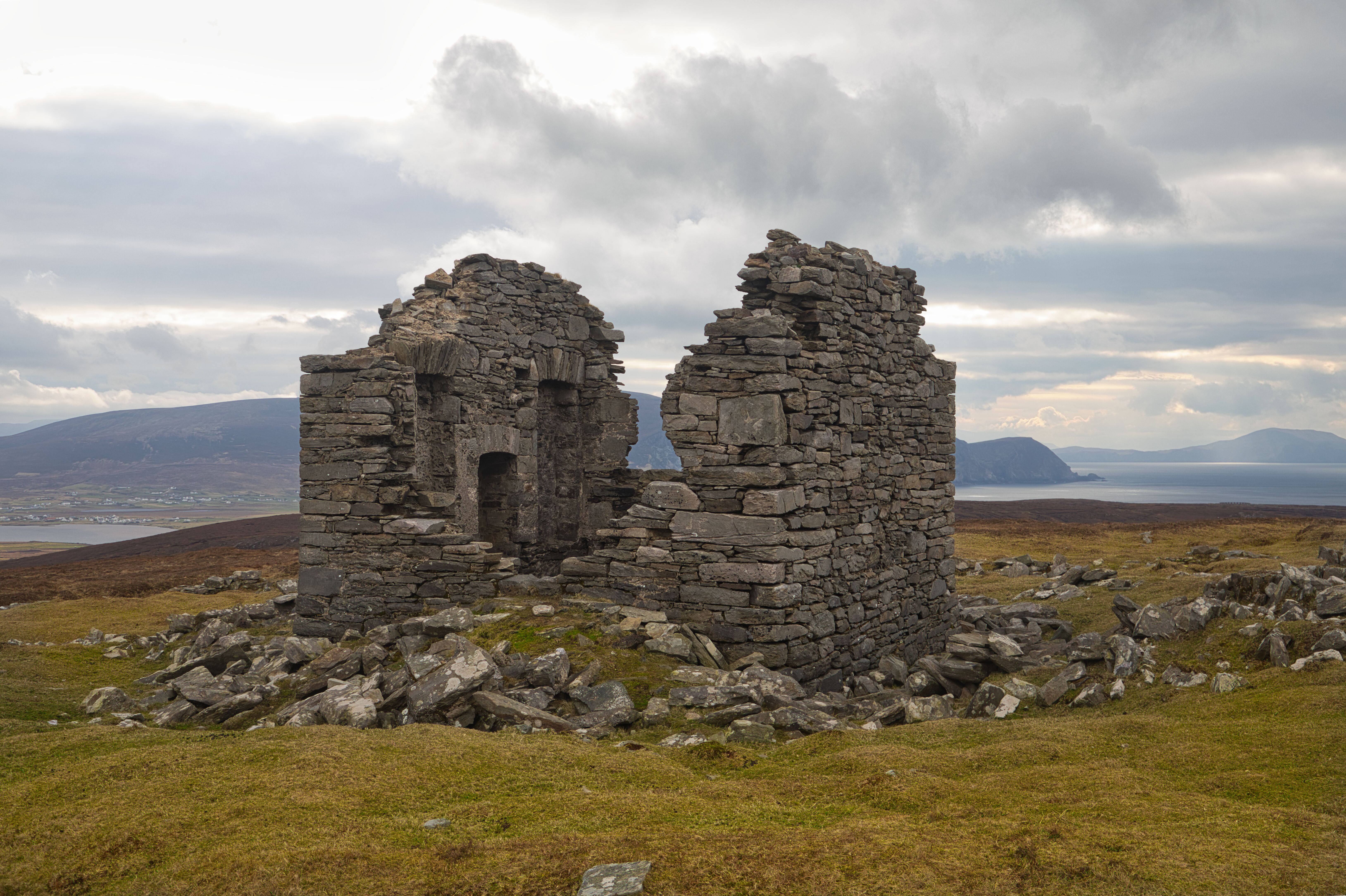
The Napoleonic Signal Tower with the Minaun Cliffs in the background.
Clare Island is just off to the right.
As I ascended that next summit, hill 269, my excitement grew a bit as I approached the ridgeline in expectation of what kind of a view will emerge. When I finally reached the edge, I was met with astonishing panoramas that took my breath away. Croaghaun Mountain loomed majestically in the distance, while below me lay the tranquil waters of Lough Nakeeroge. In that moment, after observing the steep decline, I couldn’t help but question whether the journey downward would be as smooth as I had envisioned.
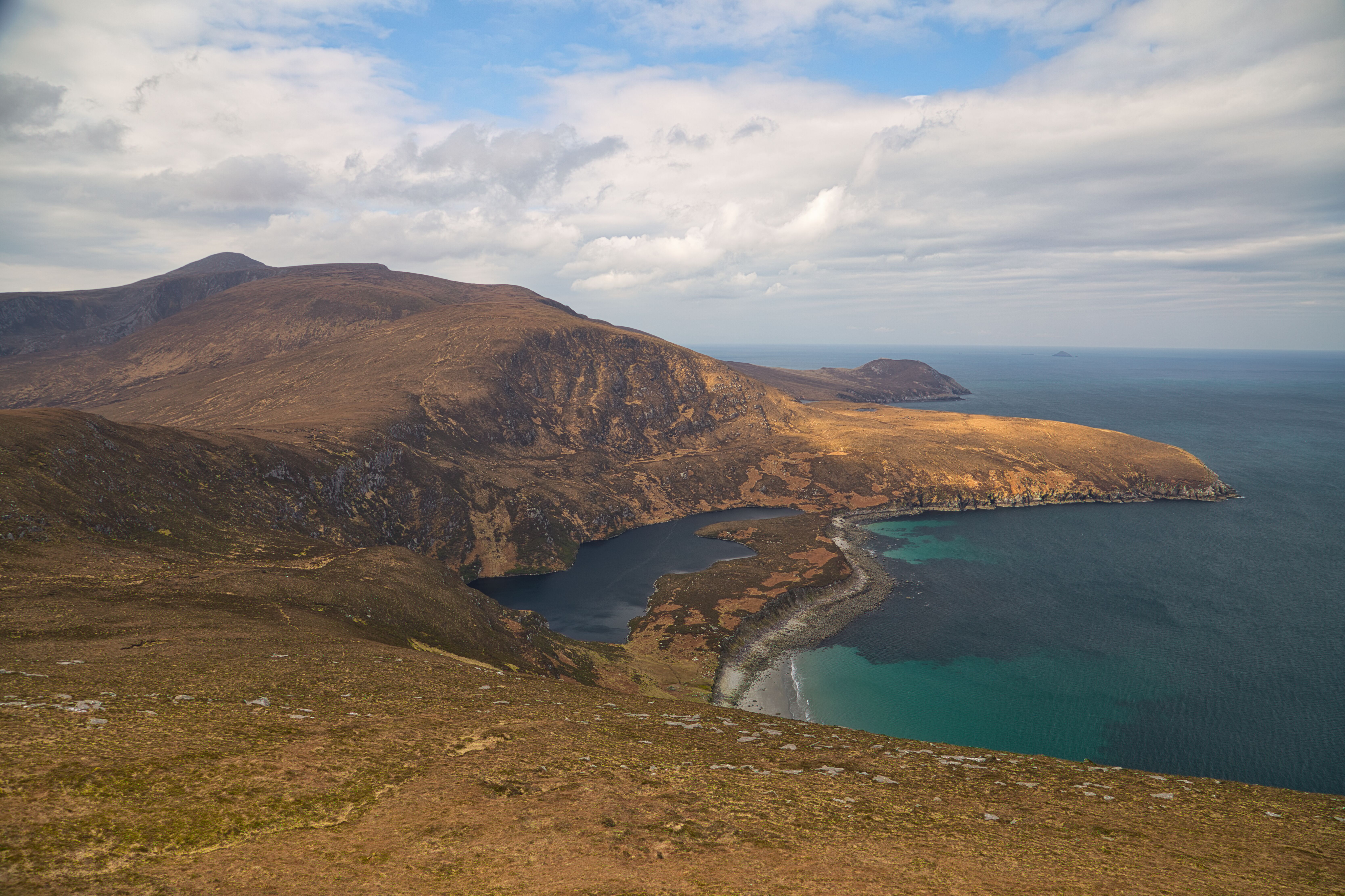
From Hill 269, a breathtaking panorama unfolds, complemented by the vibrant, crystal-clear waters of the Atlantic Ocean stretching ahead.
Reaching the spot height of 234, another high point on my route, I paused to survey the steep descent to lough Nakeeroge ahead. The gradient was much steeper than I had anticipated, and thoughts crossed my mind about how different this descent might be if I encountered any wet or bad terrain that could make the descent slippery and dangerous. Still, with a little caution and a spirit of bravado, I decided to take my chances. I selected a route that I thought would be a "good to go" one and took the "plunge", benefiting from the heather and bracken that lined my descent. Their sturdy grip against the ground gave me a bit of confidence as I navigated the terrain. Slowly but surely, I made my way down, relishing the challenge of the adventure and the thought of reaching terra firma on Annagh strand.
At the bottom of the hill, I come on the remains of an ancient Portal Tomb and a more recently constructed fish hut, commonly called the 'Scotch house'.
A closer look at the portal tomb reveals that its distinctive form is gone due to its partial destruction
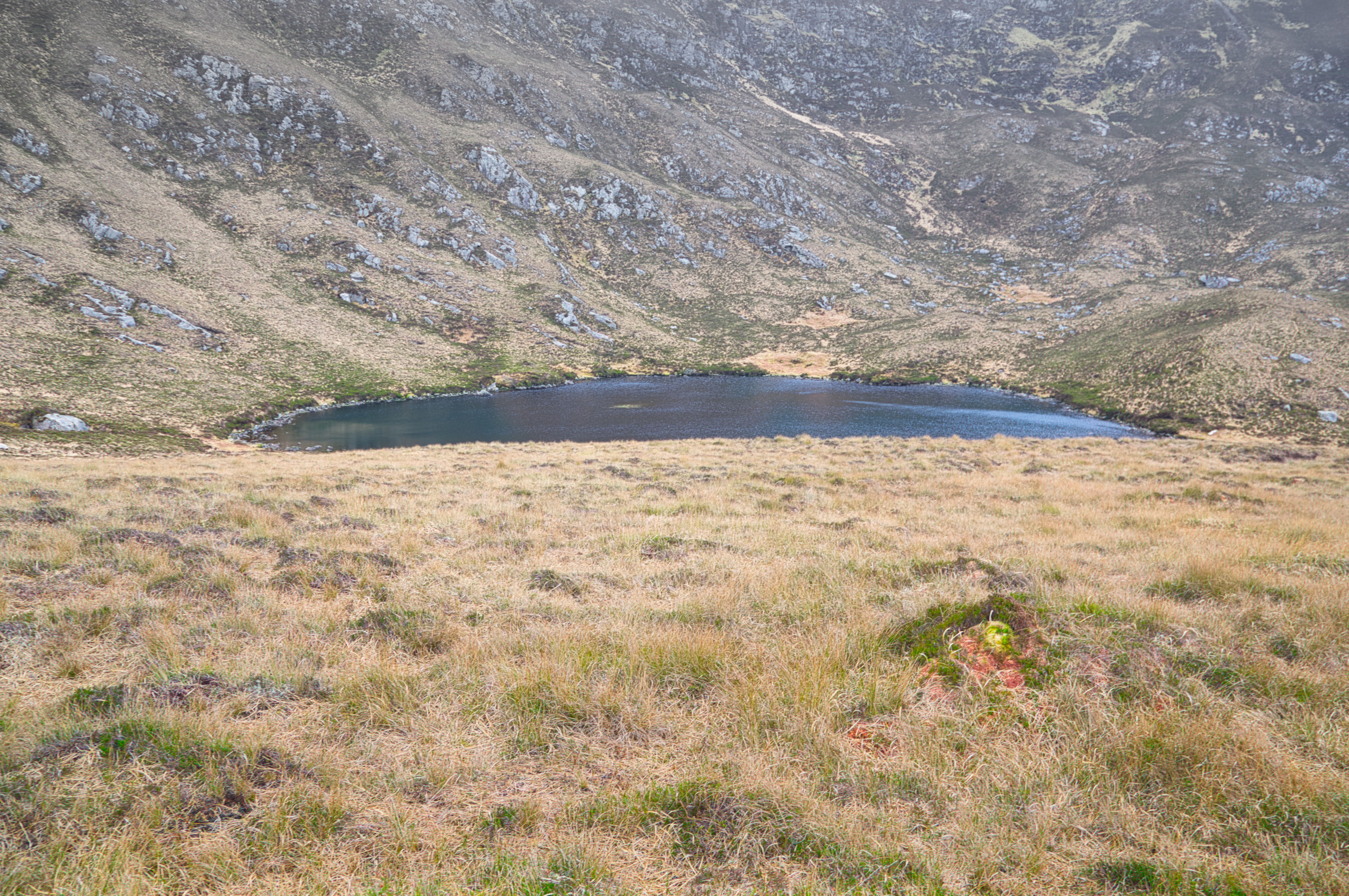
After what felt like a mini expedition, I finally arrived at the shores of Lough Nakeeroge. The sight was worth every effort. This freshwater lake, intriguingly situated so close to the sea, holds a charm that feels both isolated and mysterious. Standing there and looking up at the high ground that I just descended, I pondered for a few moments the idea that I would have to make the hard slog back up there again on the return leg but overall I couldn't really help but appreciate the remoteness of the place and the history that surrounded me. Just off the shore, an old structure beckoned my curiosity, and beside it, the remnants of what is recorded as a megalithic portal tomb peeked up from the ground. I learnt later that stones from this ancient tomb were pillaged in the past and repurposed by fishermen when they constructed the nearby salmon house, a stone structure that still retains its shape. They would arrive from Blacksod in their currachs and stay here on the western side of the lough for a few nights to rest in the house complex that I was eager to see.
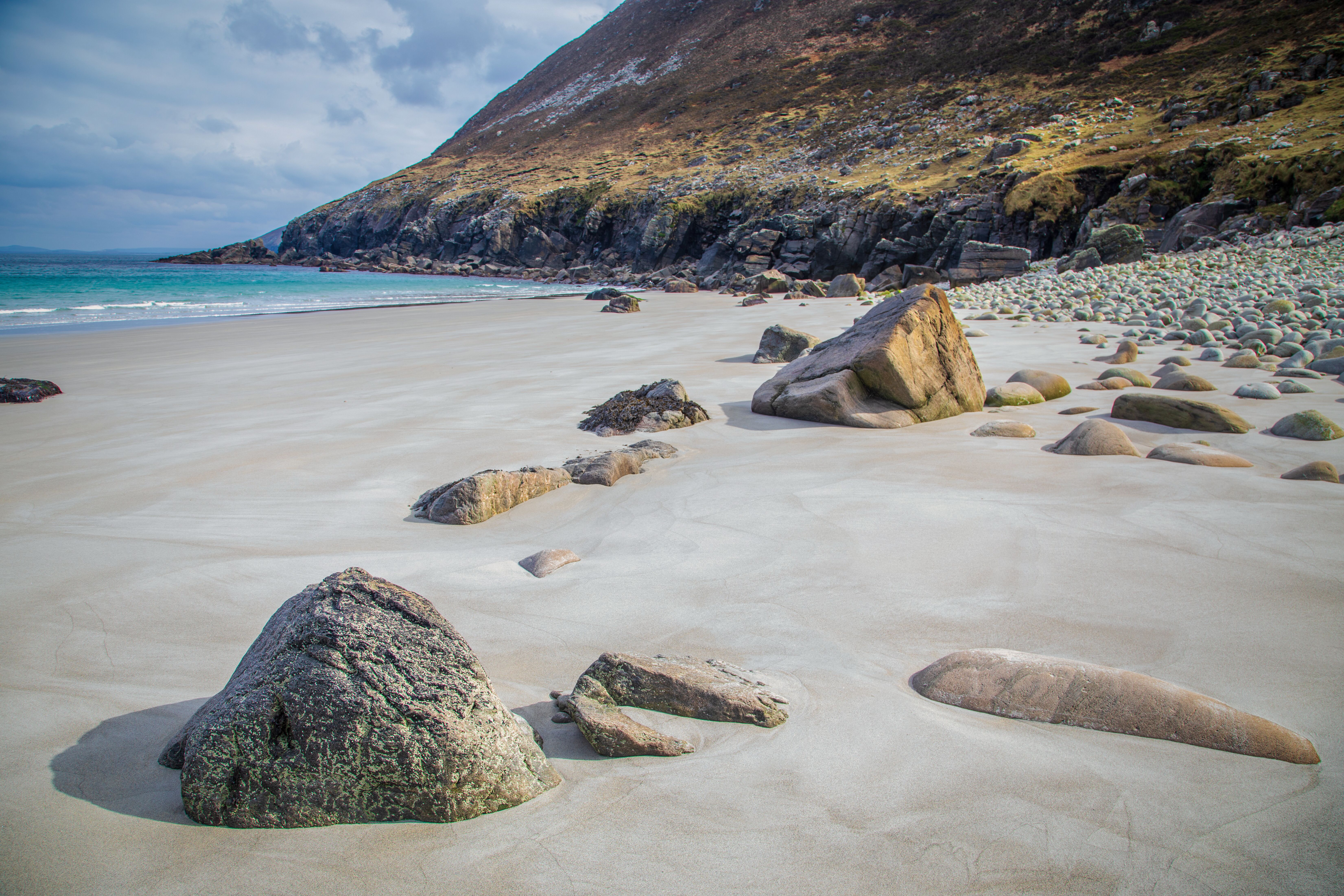
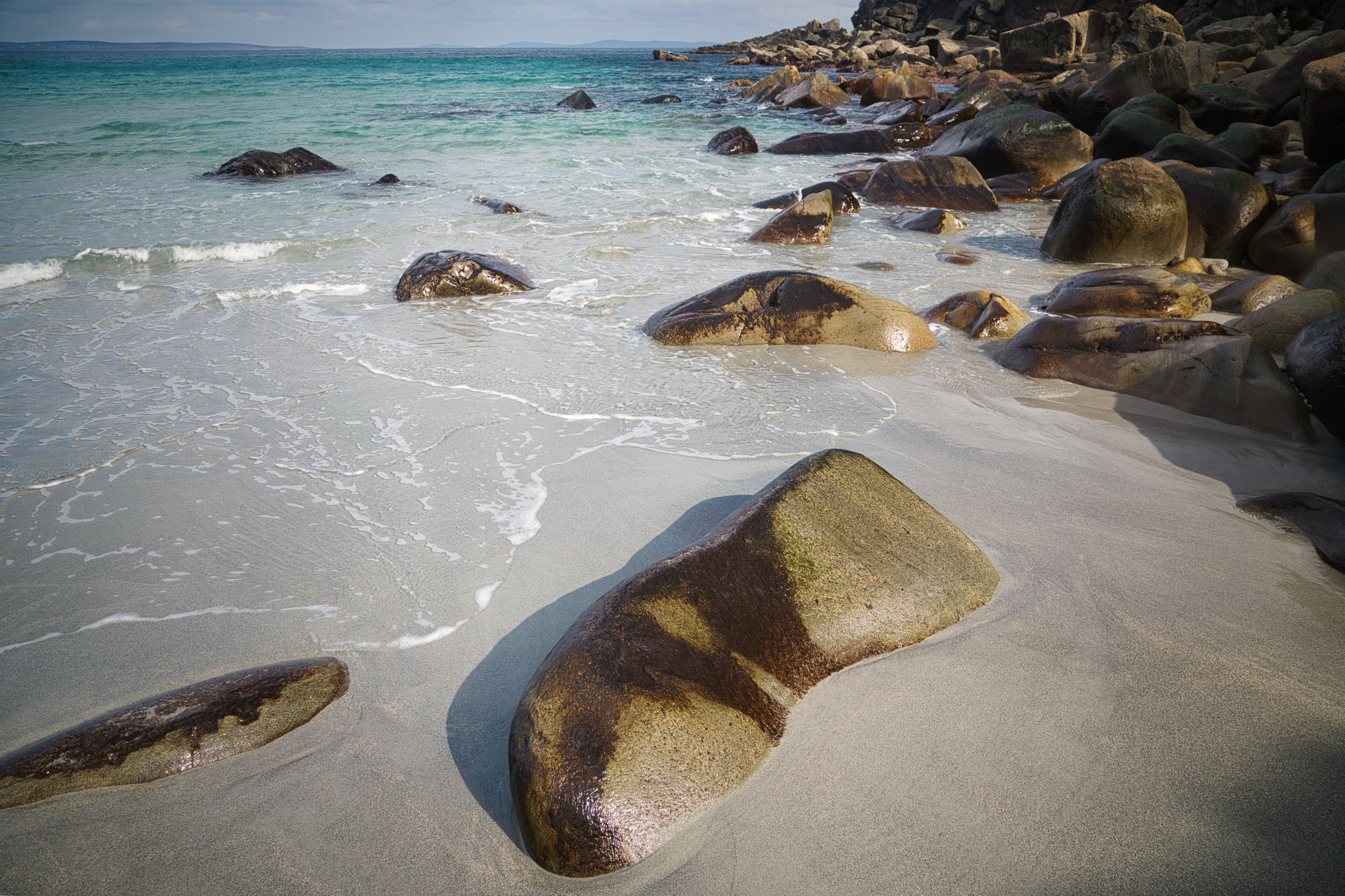
Annagh Beach is a secluded and pristine coastal gem located on Achill Island in County Mayo, Nestled between rugged cliffs and overlooking the Atlantic, it offers a peaceful retreat with its beautiful sands and crystal-clear waters. Accessible only by hiking trails or by boat, Annagh Beach is celebrated for its untouched beauty and the tranquility it provides, making it a perfect escape for adventurers and nature lovers alike.
Just a stone's throw away from Lough Nakeeroge , this pristine stretch of grey golden sand beach is one of Ireland's best-kept secrets. As you step onto the firm, glimmering sands, you'll immediately be struck by the unique sparkle created by the diluted rock that permeates the ground. It offers a breathtaking contrast against the shimmering, crystal-clear waters of the Atlantic Ocean.
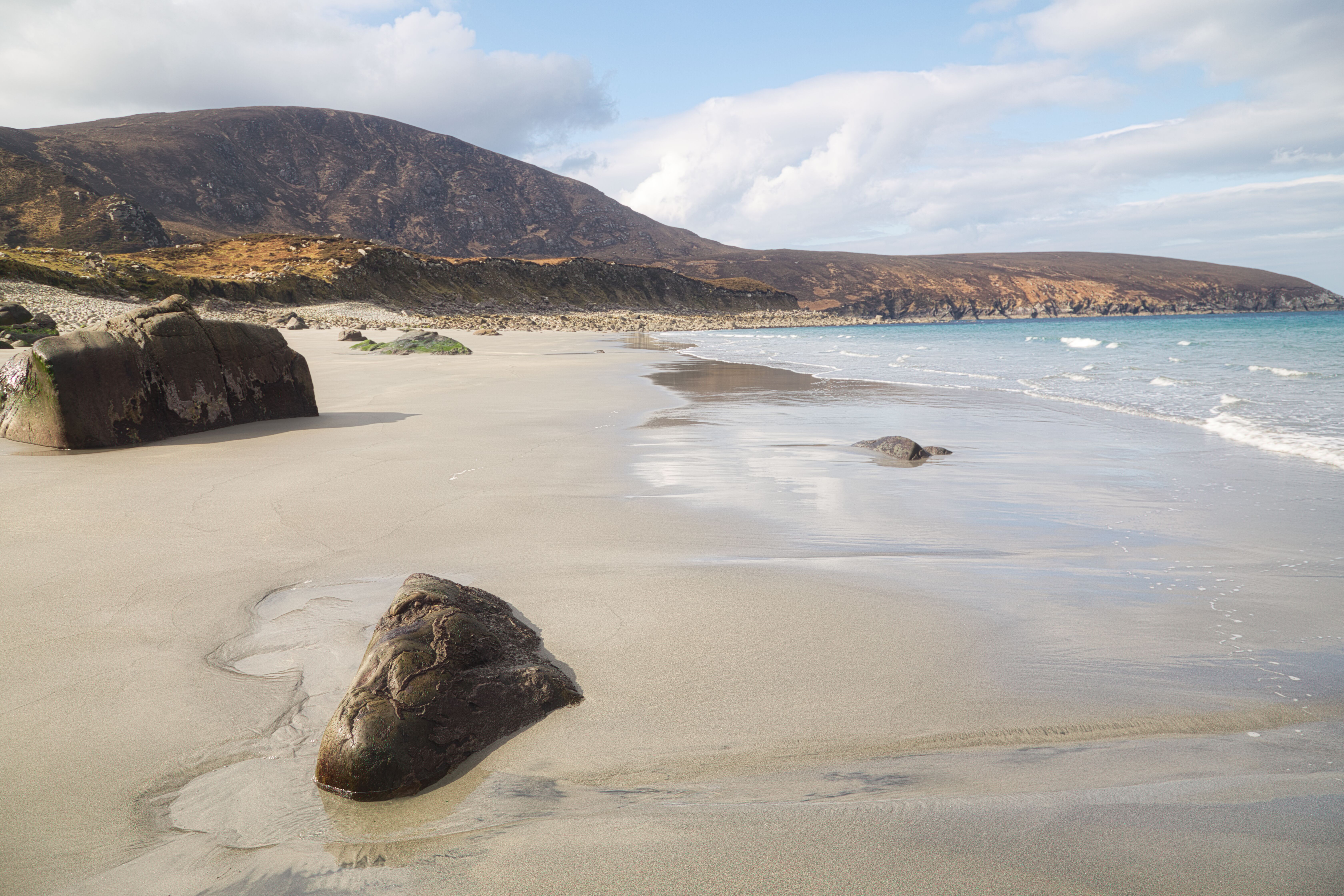
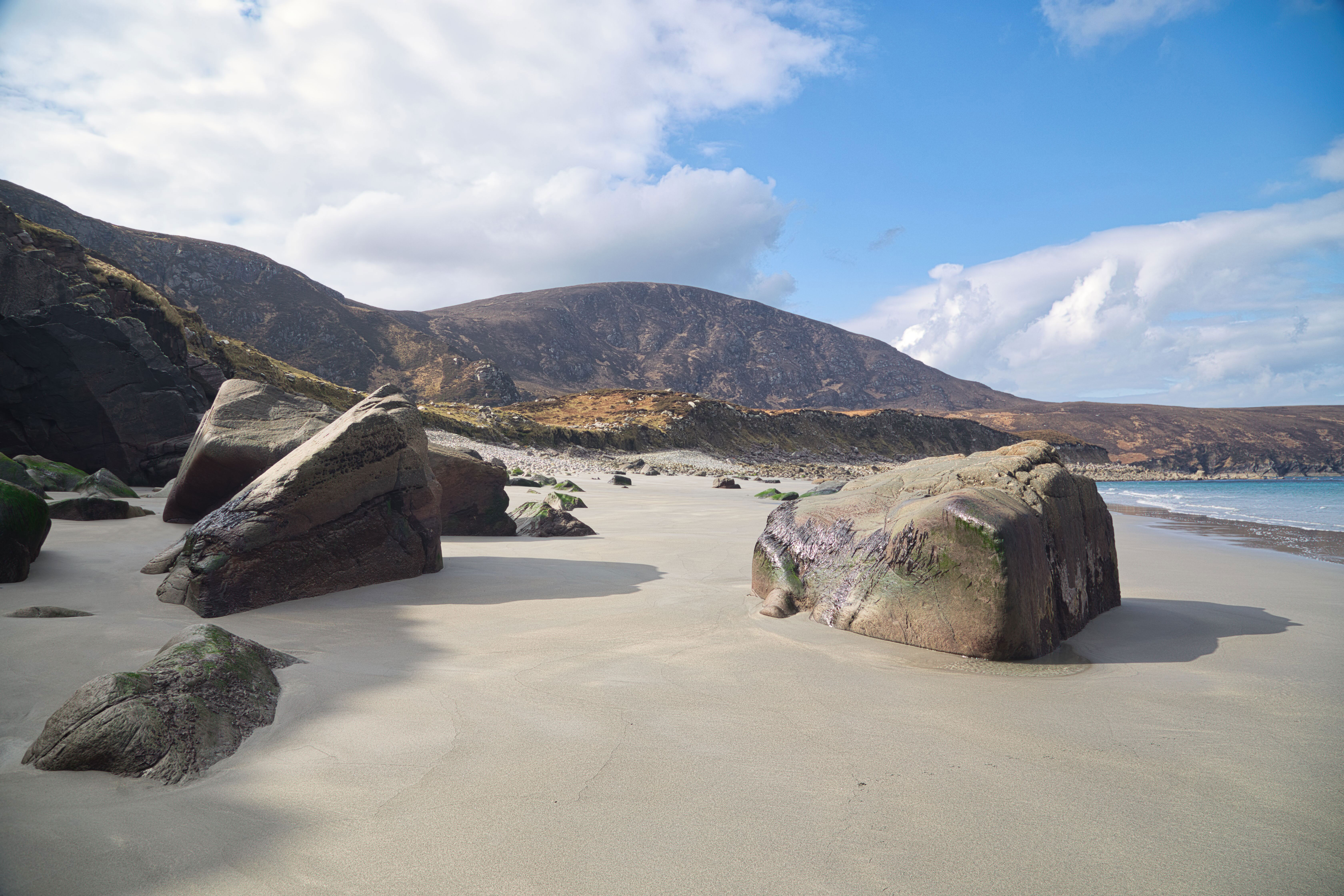
One of the standout features I noticed here of Annagh Beach is its remarkable cleanliness. This hidden jewel is remarkably free from litter.
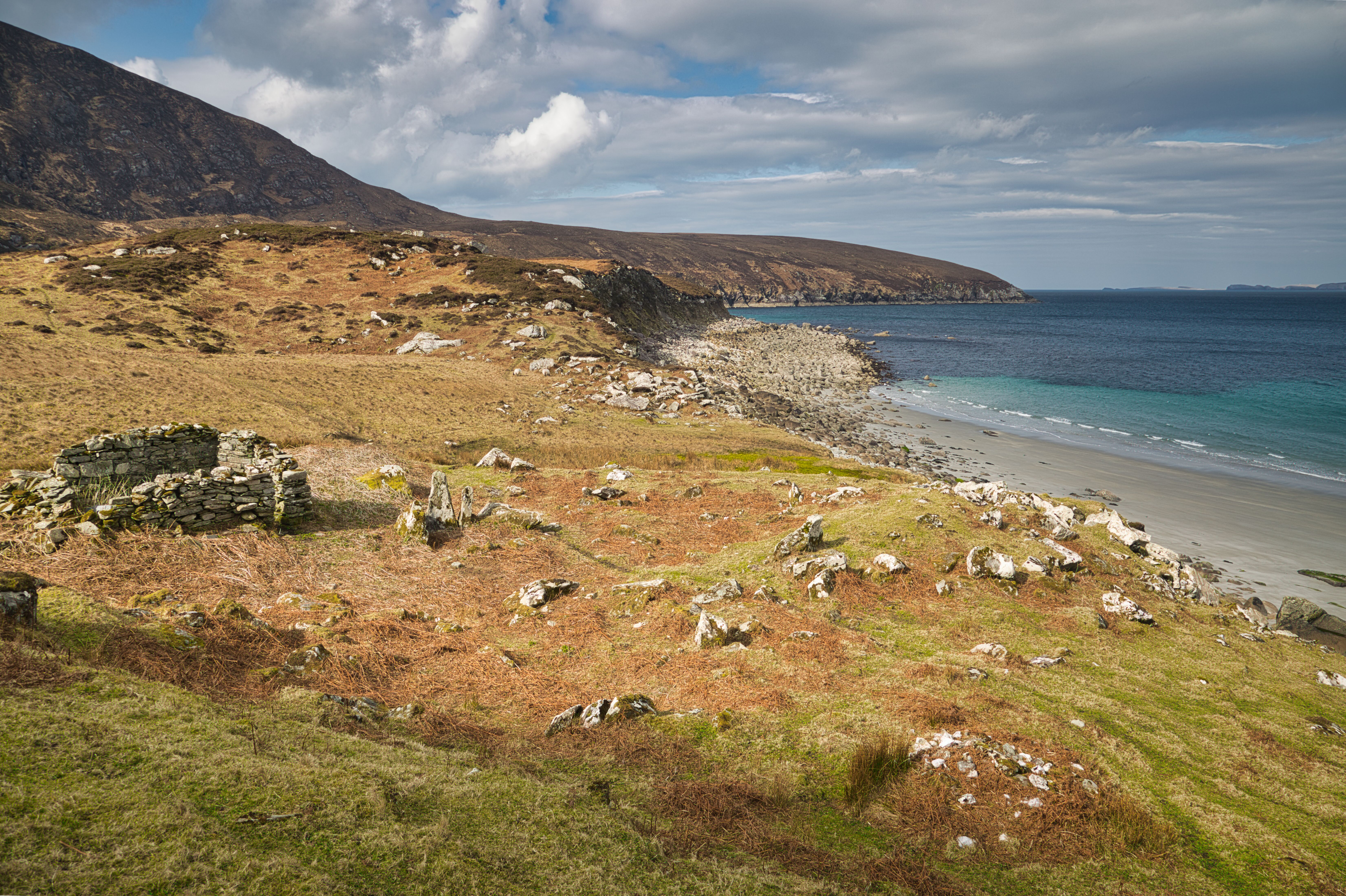
As mentioned, there is a small settlement just west of Lough Nakeeroge. It consists of at least twelve buildings in various shapes and structural conditions that are the remains of a once-thriving community. On the historic map, these houses are shown as ruins and everything here gives an indication that civilisation existed well over 200 years ago and longer back into our ancient past, as witnessed by the presence of the megalithic tomb.
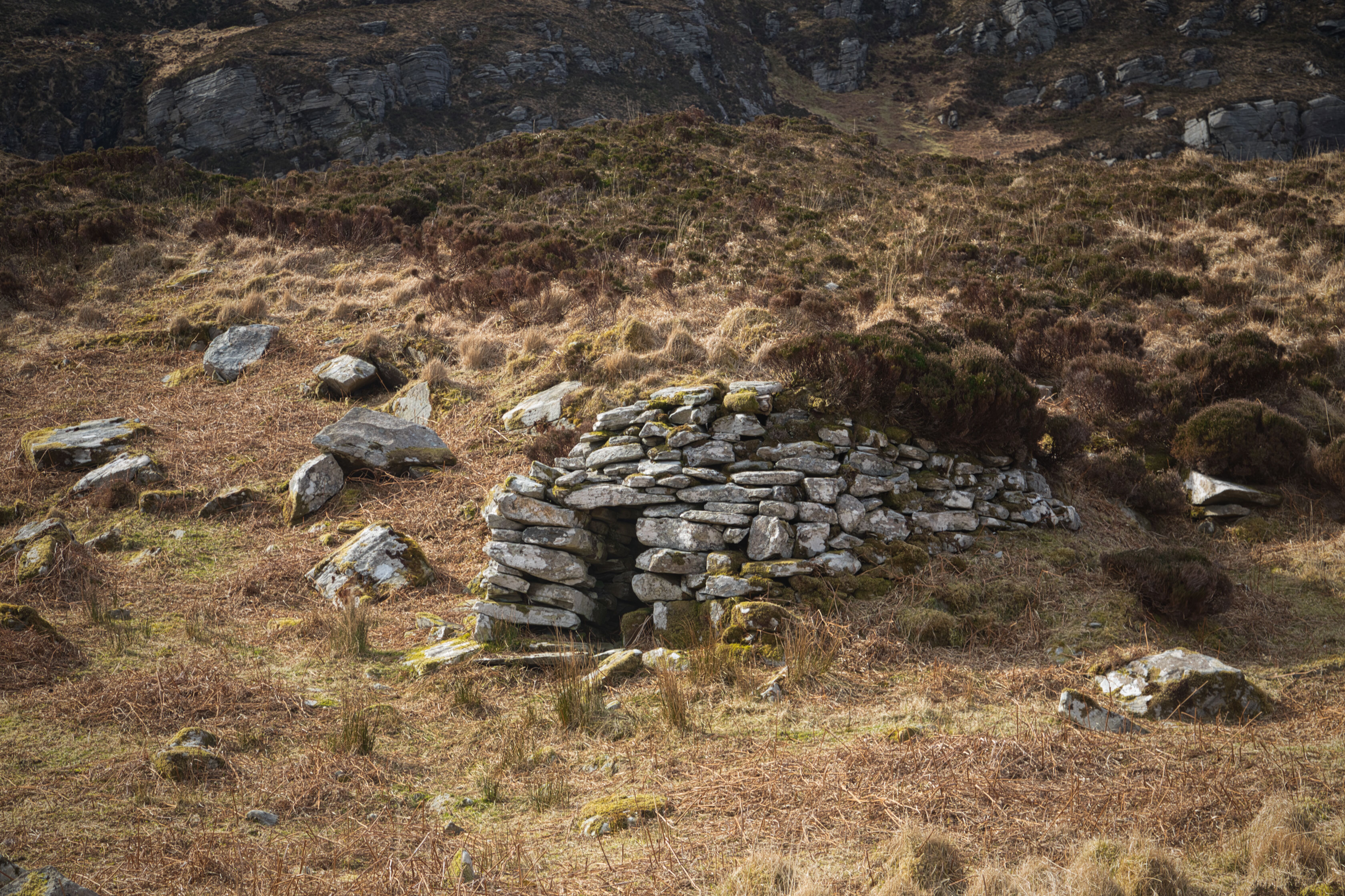
Ruins resembling a beehive hut. Theory is that it might have been a sweat house.
Ruin building situated north of the settlement.
This region is known locally as a "Booley," and like the Deserted Village and the Slievemore settlement visited earlier, denotes a makeshift community for booleying farmers who lived off the land and cared for cattle during the summer months. Lobster fishermen from Inishkea island and from Blacksod would stay here in later years to exploit the abundant fishing grounds. There is a sizable rectangular enclosure with old-fashioned lazy beds among the picturesque ruins, directly east of the village. These raised beds, which highlight the area's long agricultural heritage, were customarily used to cultivate crops.
Houses built into the surrounding terrain.
Another abandoned house with its door facing north towards Slievemore
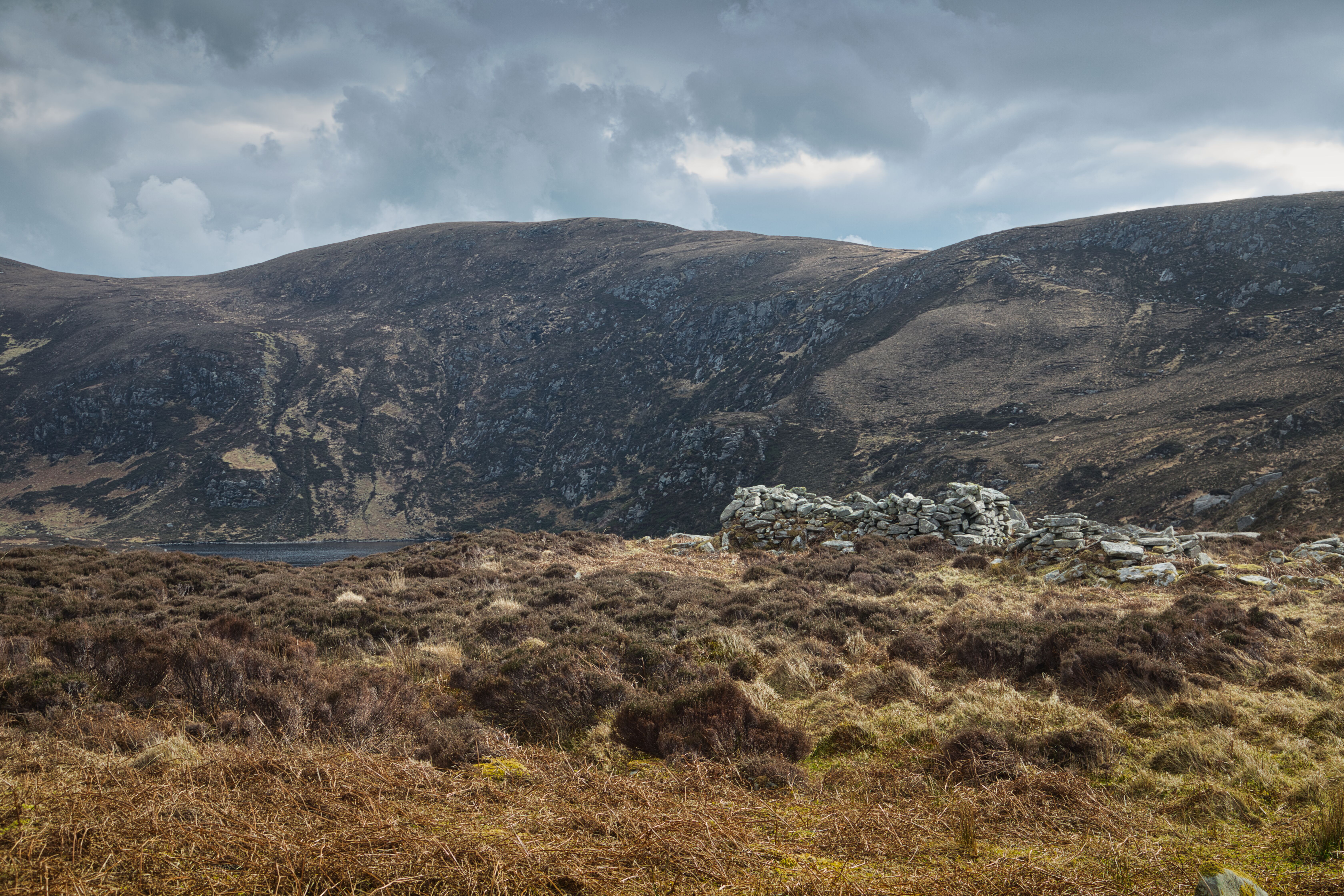
Looking back at the ridgeline and the steep hills that made the descent to Lough Nakeeroge difficult
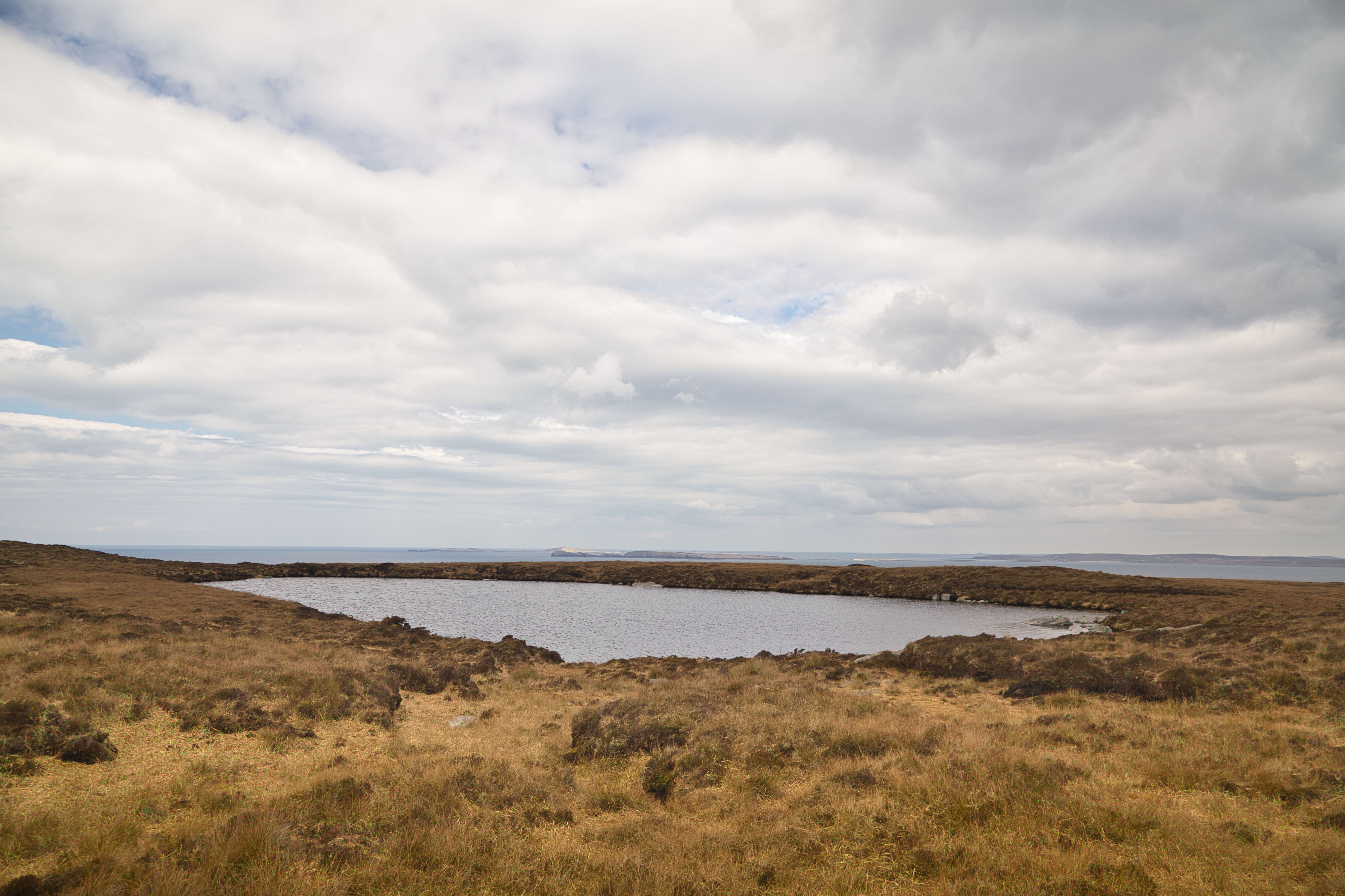
Lough Tinny
Nestled just up the hill from this village and edging closer to Achill Head lies a nice expanse often referred to as pastureland. This area, easy to walk on and dotted with small glimmering lakes that bring life to this remarkable place includes Loughs Bunnatreva, Tinny and another similar called lake, Nakeeroge West.
Lough Bunnatreva East.
Just a stone's throw away from Lough Bunnatreva East stands a Fulacht Fia—a remarkable archaeological feature from Ireland's ancient past. This intriguing pit, filled with water, served the ingenious purpose of cooking meat; stones heated in a fire would be tossed into the water, creating a bubbling cauldron big enough to prepare meals. Imagine the scene: a bustling hub of activity surrounded by lush pasture, where essential raw materials like fresh water, turf and abundant livestock made it easy to envision hearty meals being crafted right on this spot. Sheep and goat meat often most likely found its way into the pit, nourishing the inhabitants and fishermen of the nearby abandoned village, who relied on both the land and sea and the ingenuity of their culinary methods.
Lough Nakeeroge.
As the day wore on, a palpable sense of urgency kicked in. The realisation that I had to tackle the return journey up the steep incline prompted me to focus on the location I was in so I did an "Iompaíg Thart” (which, for the uninitiated, means a swift turnaround) and set out on my way. While traversing the isthmus over Lough Nakeeroge earlier, my eyes were drawn to a promising sight at the rear of the lake. It looked like a potential route, one that seemed to offer an easier path out than the one in—even if it was still fairly steep. With a mix of curiosity and a sense of purpose, I headed towards this newfound option, hoping it might spare me some additional strain.
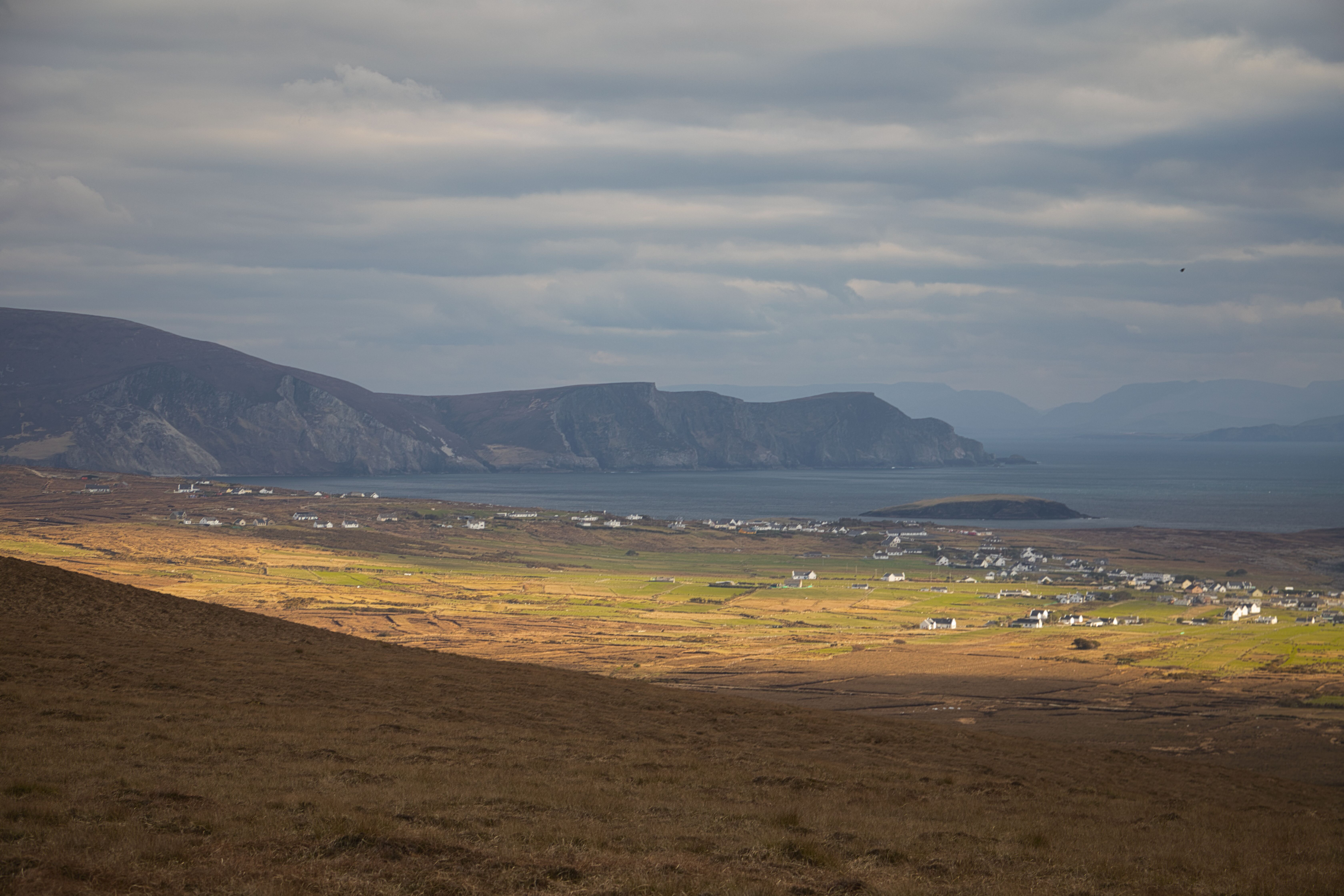
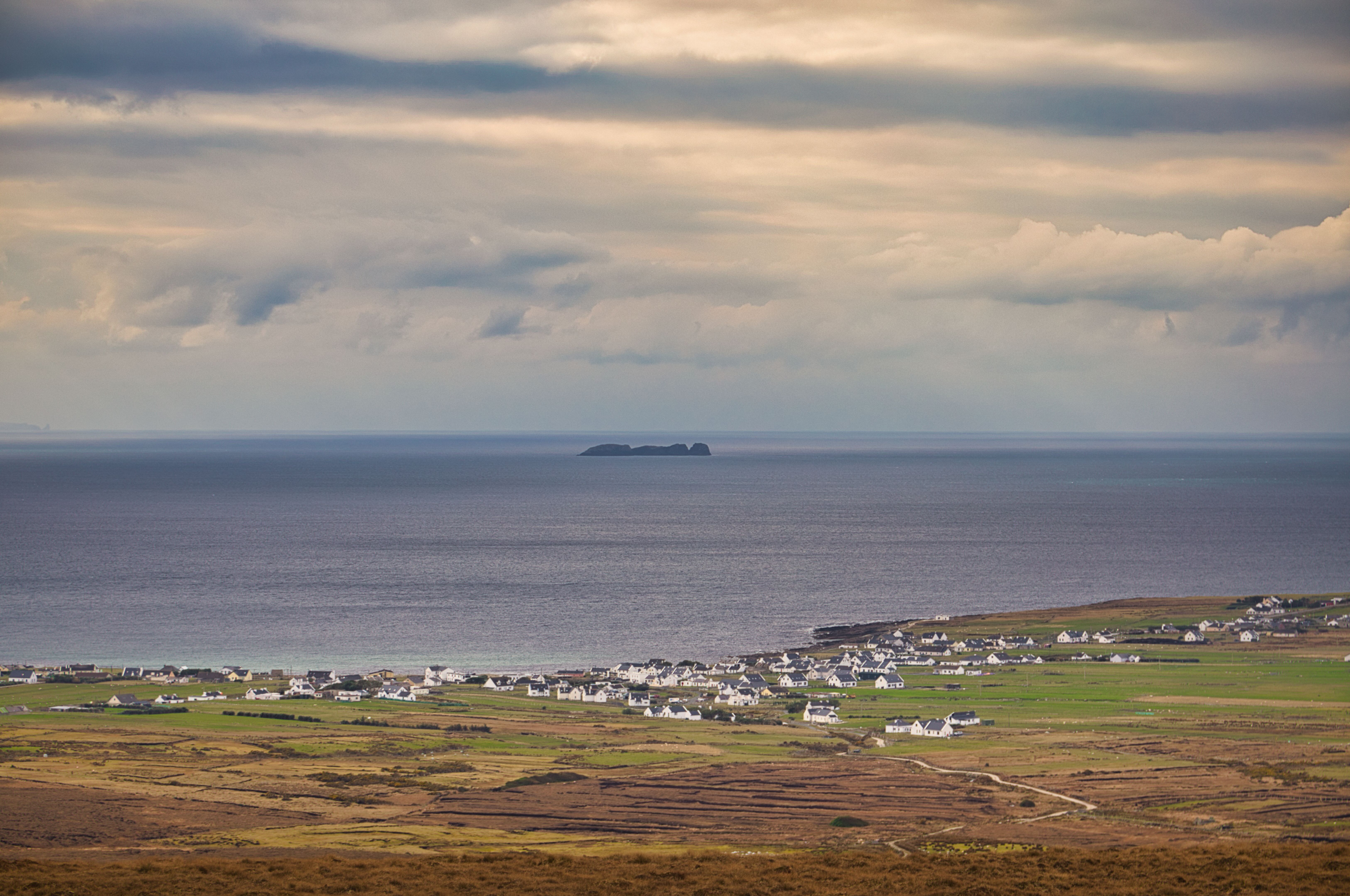
Standing on the Slievemore and Croaghaun high ground, a wonderful vista of Dooagh and the Minaun heights come into view.
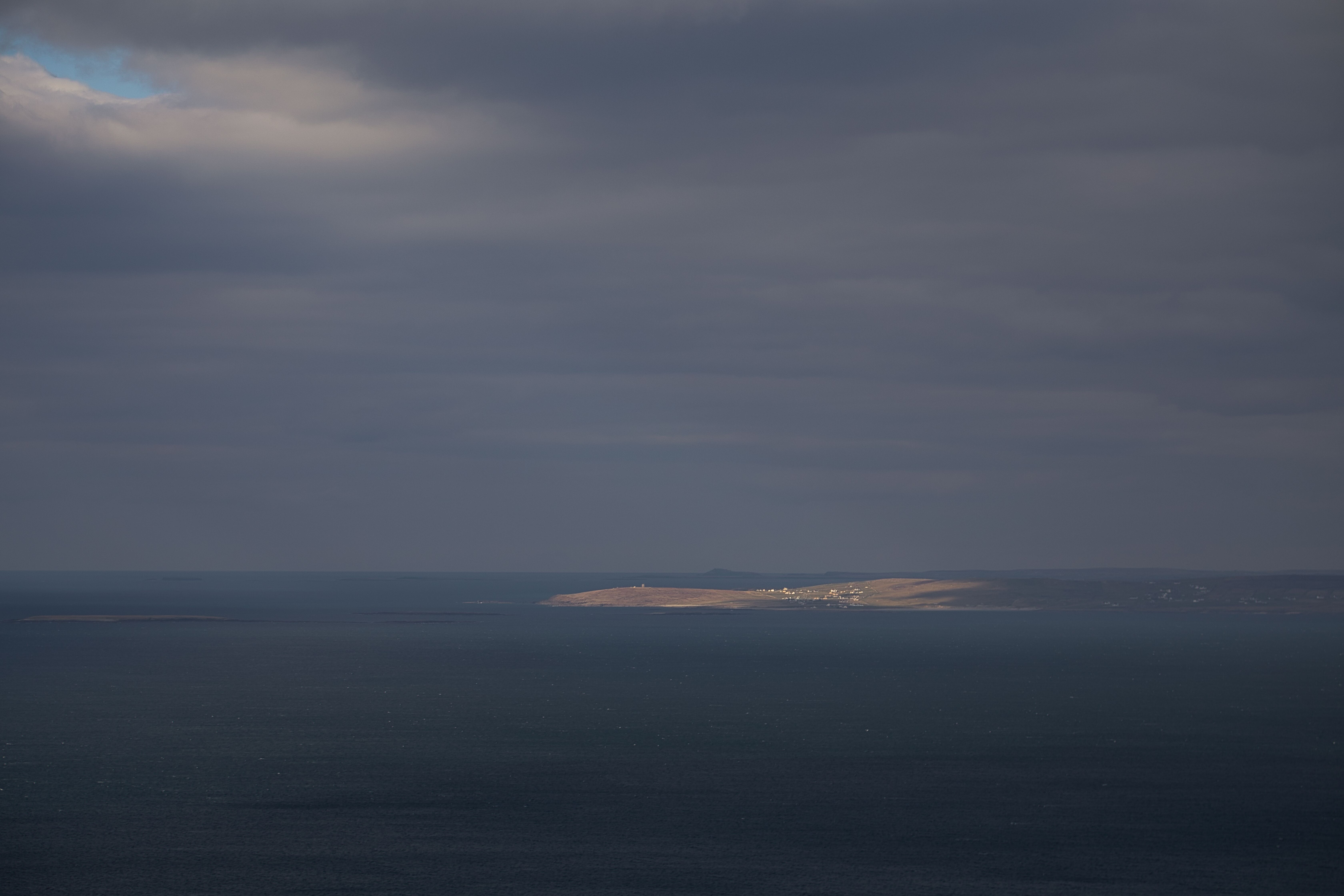
Today's view of Bills Rocks is remarkable. These rocks are named after the 1781 incident when the Royal Danish Navy frigate 'Bornholm,' under Captain Mathias de Bille's command, tragically floundered on them.
Upon reaching the ridgeline, I felt a wave of relief. From there, the terrain transformed into a picturesque setting that allowed for a relatively gentle descent toward the Dooagh loop trail, eventually reaching the Deserted Village path. I made my way back along this route to the car park, a mixture of fatigue and satisfaction settling in. The journey had not only tested my resolve but also gifted me with insightful moments of reflection amidst the stunning backdrops and the local history. A unique and fantastic place to visit!
Another Napoleon tower is just visible when you look across at Glosh on Blacksod. Approximately 80 of these towers were built along the Irish shore back in the day.
🇮🇪☘️
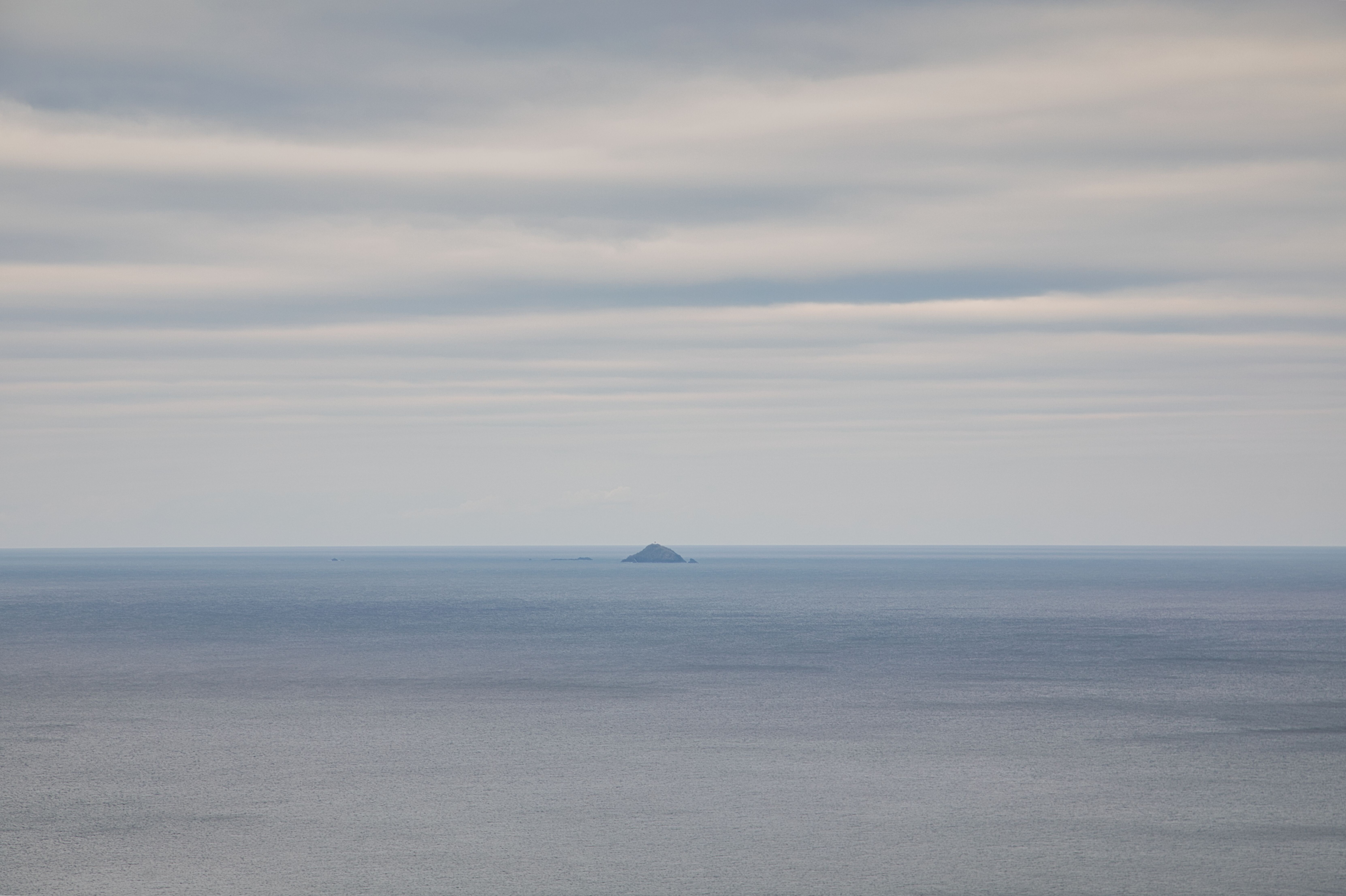
Blackrock Island, just off Achill Head, stands today as a poignant reminder of the Rescue 116 crew who tragically lost their lives in the early hours of 14 March 2017.
Carpe Diem
Example Text