Corraun Hill, Slieve Aghkerane, and a large erratic boulder! 🥾🥾
“You’re off to great places, today is your day. Your mountain is waiting, so get on your way.”
Dr Seuss
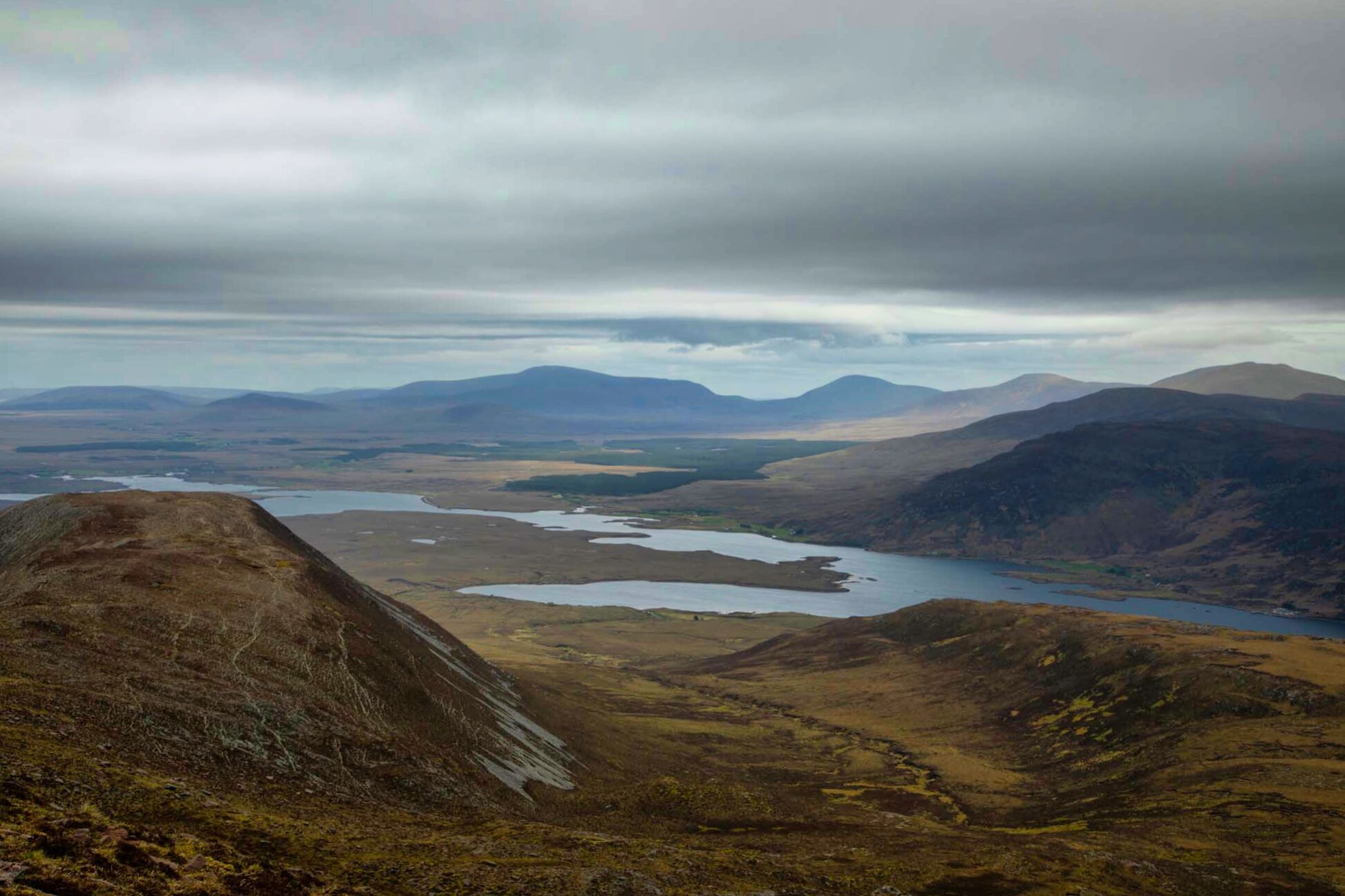
On Ireland's west coast, in County Mayo, lies a peninsula known as the Corraun Peninsula. From the mainland near Mulranny, it spreads out westward for about 10 km toward Achill Island. The peninsula is a part of the Achill parish and is located directly east of Achill. The peninsula and Achill Island are joined by the Michael Davitt Bridge at Achill Sound.

Achill Sound and the Michael Davitt Bridge viewed from the top of Corraun Hill.
*In the foreground is the ruin of a church built in 1854-6 by the Revd. James Henry on a rectangular plan, which represents an important component of the mid-nineteenth-century ecclesiastical heritage of County Mayo. Located in a field about 40 meters from the shoreline, this 19th-century church is not shown on the 1838 OS 6-inch map but is indicated on the 1920 edition as 'R.C. Church'. This church was closed in 1960.
Slieve Aghkerane (541 m) and Corraun Hill (524 m) are the two highest points in Corraun. It is this area and the plateau around these two peaks that I set off to explore today.
*On the Irish Ordnance Survey map, Slieve Aghkerane (also known as Corraun Hill East Top) is not indicated. Despite being 17 meters taller than Corraun Hill, this location is only designated as a spot height. The name isn't mentioned in "Irish Hill and Mountain Names" by Tom Tempan either. It appears from looking at other mountain names that start with the letters "AGH" that the name may represent "a lookout point." The significance of this, "a lookout point on Corraun," is somewhat clear when you stand on the mountain's peak and survey the surrounding area. Kerane may be an earlier spelling of Corraun.

OSI Map 30.

A stunning view from the summit of Corraun Hill.

Parking the car at the Church in Corraun, my route follows a clockwise direction around the Corraun Plateau.

The village of Corraun with Achill Beg Island and Clare Island in the background viewed from the lower slopes of Corraun Hill.

A view of the summit of Corraun Hill from the first cairn at 400 metres on the ascent..
After leaving the car at the Church of Our Lady Queen of the Universe and Christ the King in Corraun, it is not far along the main road before turning right onto a dirt road that leads up to the bottom slopes of Corraun Hill. From here, it is simply a matter of continuing up the hill for 400 meters or so, past the first of several cairns that I will encounter today, and then an easy trek onto the summit at 524 meters.
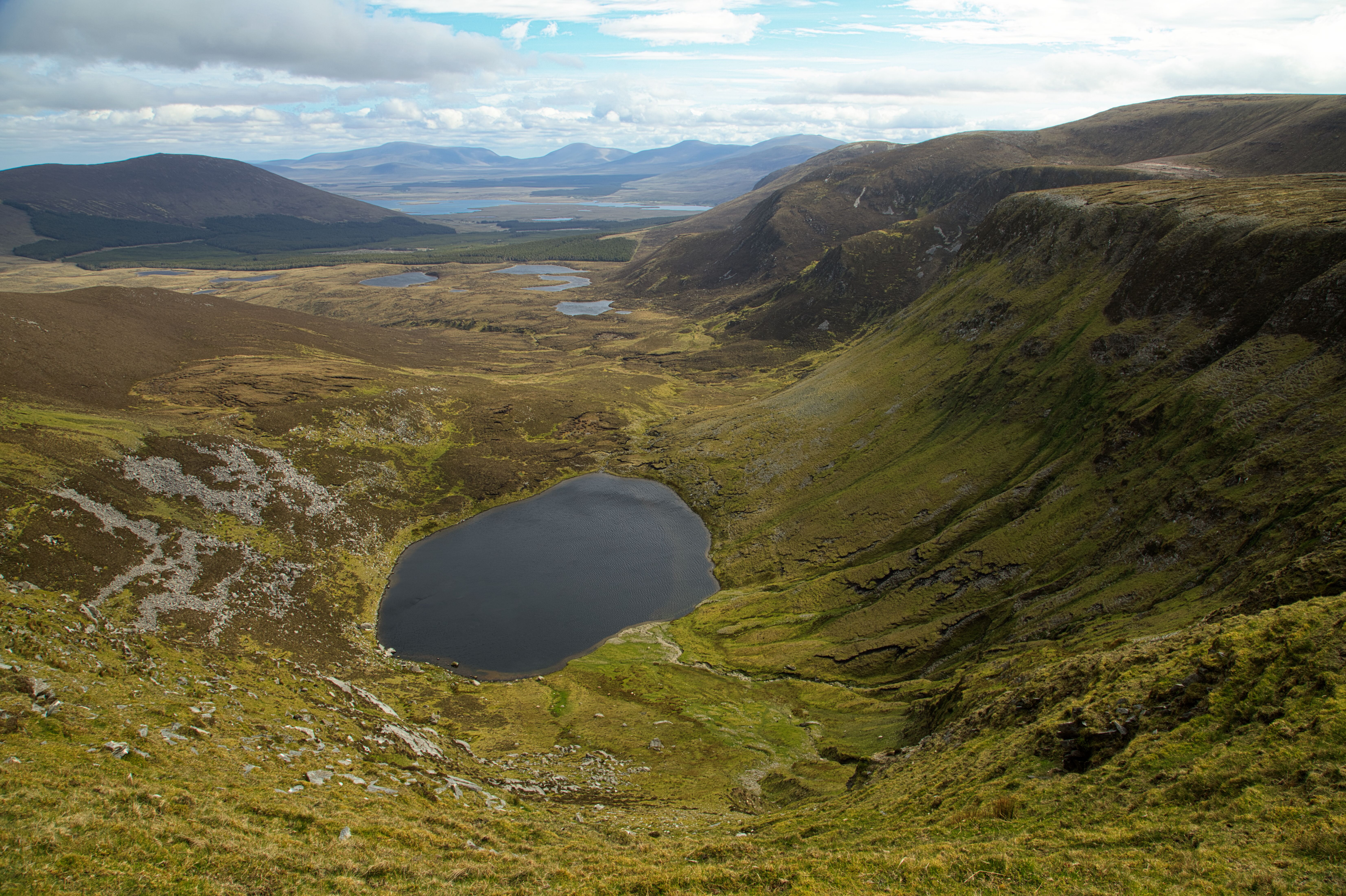
Knockacorraun Lough and the north facing cliffs of Slieve Aghkerane as seen from the plateau.
The top of Corraun Hill is covered with stone and is notable for the presence of a ruined cairn and trigonometry pillar. Great views can be had in all directions, but Slieve Aghkerane's north-facing cliffs certainly offer the most stunning panorama. They tower above the countryside below with its many loughs and woodlands, reaching heights of roughly 300 to 400 meters.

The trigonometry pillar on the summit of Corraun Hill with Croagh Patrick pictured in the background.

Northern slopes of Slieve Aghkerane.
(The summit is located at top right of picture.)

Lough Cullydoo in the foreground, and working outwards, Lough Laur, Lough Nambrackkeagh, *Loughaunfiddaunbuntack and Lough Gall seen from the slopes of Slieve Aghkerane.
These lakes featured in a previous recorded blog where I wrote about one of the longest named lakes in Ireland.
Due to the terrain's “good to go” condition, the slightly more than 2-kilometer journey from Corraun Hill to Slieve Aghkerane—via spot height 421—is made reasonably easy. Pieces of rock and stone laying flat on a dry, grassy moss-laden ground like natural carpet makes the plateau very accessible to circumnavigate.

The Plateau looking East towards one of many cairns.
The village of Mulranny to the east and the magnificent islands in Clew Bay are visible from the heights around Slieve Aghkerane.
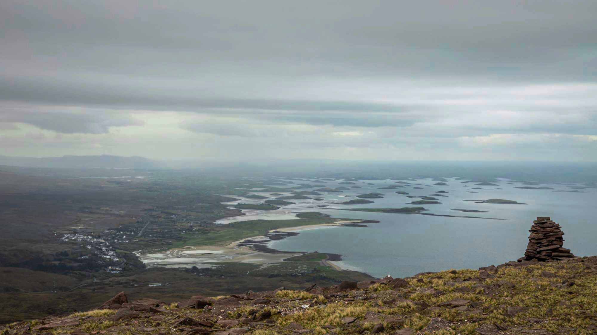
Mulranny village with its seaside beaches and some of the islands in Clew Bay
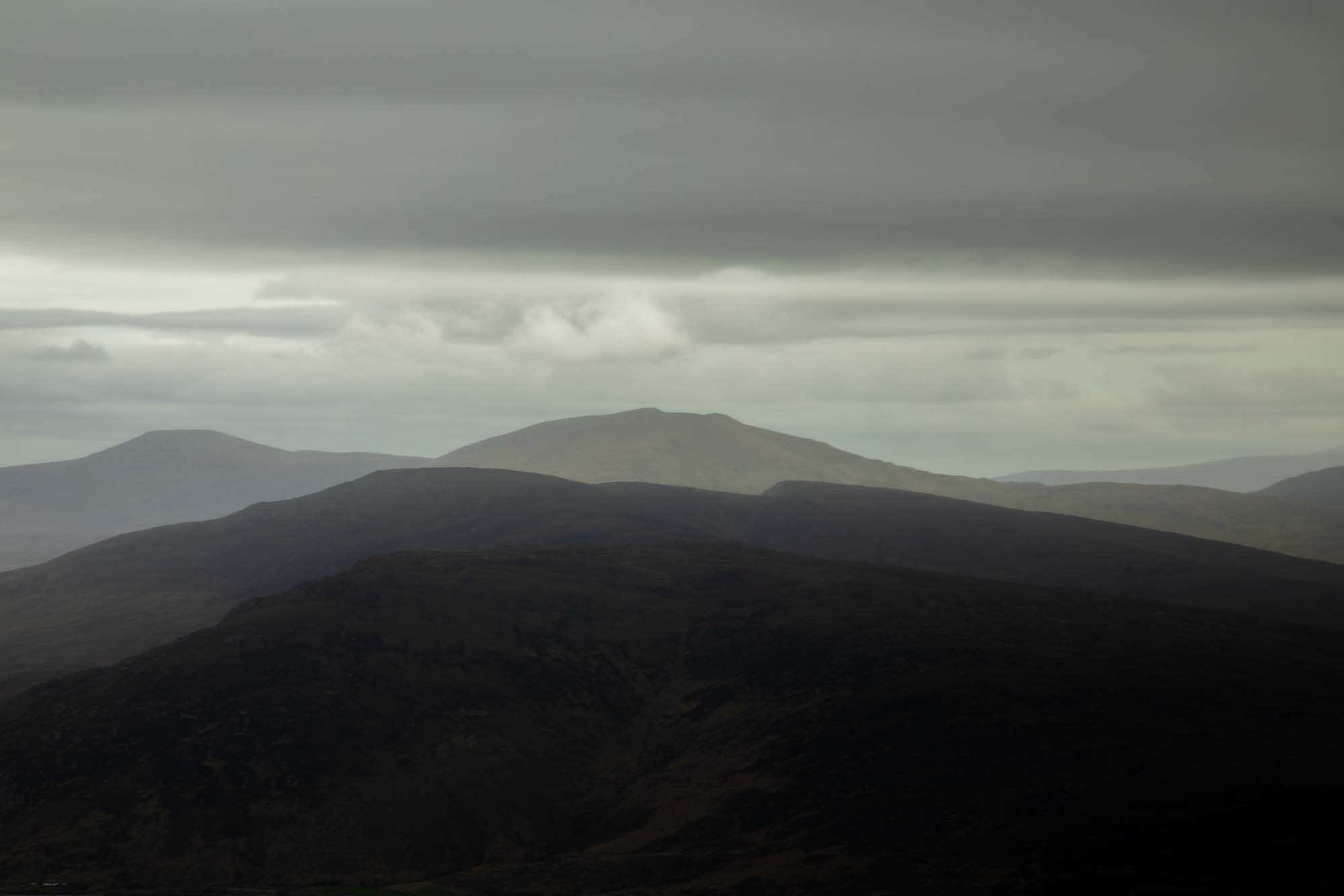
While I could have lingered and watched the scenes for a little while longer, it was becoming late and rain was expected in the early evening. In fact, I could see rain clouds beginning to form above Mweelrea Mountain and the Sheeffry Hills across Clew Bay, and I knew the rain front wouldn't take long to get here.

*Going down the side of the plateau, I cross over a lot of the natural stone that makes up the geology of the place. The mountains were created and molded during the Ice Age by glacial ice that eroded the mountain summits and sides. Corraun Hill is formed of Dalradian bedrock, in contrast to the other hills to the east, like Slieve Aghkerane, which are composed of Lower Carboniferous Old Red Sandstone.


Here, an unusual feature of a large boulder being held up on one side by a pebble shows the distinctive red-pink color of the rocks.
Turning on the eastern edge of the plateau to head back on the return leg, I decided that I would make the descent towards Lough Ard (High Lough), lying at 200 meters. From there, the plan would be to pick up the track leading from the lake and follow it down to the main road.
Ballycroy and the Nephin Begs in the distance.
Another good view looking north.
Once down on the road, it's not too far to walk to reach the car. When I take a look back at the mountains, there is a good view of the plateau range, and I notice that it is already starting to be obscured by clouds. Happy that I got my timing right before the rain came, there's nothing left but to hop in the car and head home...... And another very enjoyable hike is accomplished!

A cloudy Corraun Hill, Slieve Aghkerane and Plateau.

The local flock inhabitants newest arrival, about an hour old, huddles up to its mother for protection on the side of Corraun Hill.